Marilyn · North-West Highlands
Carn na Dubh Choille
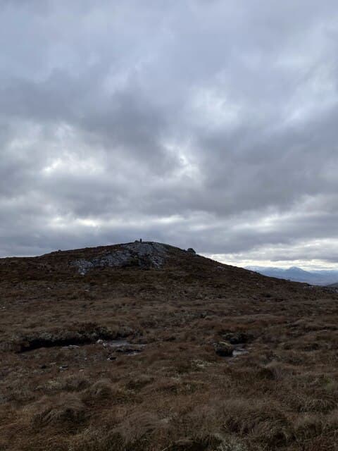
Carn na Dubh Choille — cairn of the dark wood — is a 480m rise at NH 387 673 between Strathconon and Strath Bran. The wood that gave it its name has long since gone, leaving open heather; the cairn on top is a substantial Bronze Age structure rather than a modern walker's pile.
Gaelic: “cairn-topped hill, of the, black” · Pronunciation: karn na doo choille
Quick facts
- Height
- 480m/ 1575ft
- Prominence
- 159 m
- Grid ref
- NH 38705 67337
- Nearest city
- Inverness· 35km
- Dogs
- Dogs on lead required near livestockDog-friendly guide ↗
Height and prominence cross-checked against the Database of British and Irish Hills (CC BY).
No GPX track yet
Walked this route? Share your track to help other walkers.
Standard route
heather and bog 65% · grass slopes 25% · rocky summit 10%
Easiest from the A832 layby near Achanalt station, walking south up the open hillside on a faint stalkers' line. The summit is reached in around 2 hours by the direct line; 3 hours total including the descent.
Terrain
Heather moor over schist, with deep peat banks on the lower slopes that drain into the Bran river. Higher up the heather gives way to short grass and the summit dome is firm walking around the ancient cairn.
In winter
A modest 480m means snow cover is patchy and short-lived. Strath Bran funnels a hard easterly that strips the ridge bare; the cairn area can be icy after thaw refreezes overnight.
This hill is in the Torridon SAIS forecast area. Check SAIS forecasts in winter (December–April).
Best time of year
Getting there
- Glasgow5h 49m
- Edinburgh6h 55m
OS maps: OS Landranger 20, OS Explorer 437S
Mobile signal: Poor. No coverage start to finish. Bring a paper map and compass.
Current conditions
Daylight Today
- Sunrise
- 05:09
- Sunset
- 21:41
- Civil dawn
- 04:16
- Civil dusk
- 22:35
NOAA Solar Calculator · 30 July 2026
Around Carn na Dubh Choille on the SCOT network
Getting there, basing yourself, and what to do off the hill.
Getting there: Dingwall station
Ben Wyvis approach; Easter Ross; junction for Kyle and Far North lines
19km from the hill
tripscot.co.uk
On TripSCOTBase yourself in Inverness
Highland capital — gateway to Cairngorms, Affric, Far North
36km from the hill
tripscot.co.uk
On TasteSCOTAfter the hill: Glen Ord
Muir of Ord — Black Isle distillery; the Singleton range's Highland anchor
22km from the hill
tastescot.co.uk
Carn na Dubh Choille — common questions
- Is Carn na Dubh Choille a hard climb?
- Carn na Dubh Choille is rated 1/5 (easy) on the OutdoorSCOT scale. Underfoot: Heather moor over schist, with deep peat banks on the lower slopes that drain into the Bran river.
- What is Carn na Dubh Choille's prominence?
- 159m of prominence. That's the vertical drop from the summit to the col that links Carn na Dubh Choille to the next higher ground. That drop is what qualifies it as a Marilyn — a hill with at least 150m of descent on every side.
- When is the best time to climb Carn na Dubh Choille?
- March, April, May, June, July, August, September, October give the most reliable conditions on Carn na Dubh Choille. Beyond that window the high ground turns wintry: carry full mountain kit, be confident navigating, and check the SAIS avalanche forecast for the area.
- Is Carn na Dubh Choille dog-friendly?
- Yes, but dogs must be kept on a lead — there is livestock or ground-nesting bird interest on the route.
- Is there mobile signal on Carn na Dubh Choille?
- Poor. No coverage start to finish. Bring a paper map and compass.
- Is Carn na Dubh Choille safe in winter?
- A modest 480m means snow cover is patchy and short-lived. Strath Bran funnels a hard easterly that strips the ridge bare; the cairn area can be icy after thaw refreezes overnight.
Get the OutdoorSCOT weekly
One email a week — new route, hill and bothy guides, seasonal conditions and the odd hard-won lesson. No spam, unsubscribe in one click.