Marilyn · North-West Highlands
An Cabar
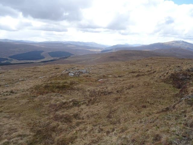
An Cabar — the antler — rises to 558m at NH 257 641 on the north side of Glen Orrin, west of Strathconon. Its name describes the jagged profile when seen end-on from the strath. It is the south-west outlier of the Fannich group and gives an open, airy walk well outside the Munro circus.
Quick facts
- Height
- 558.3m/ 1832ft
- Prominence
- 250 m
- Grid ref
- NH 25734 64103
- Nearest city
- Inverness· 45km
- Dogs
- Dogs on lead required near livestockDog-friendly guide ↗
Height and prominence cross-checked against the Database of British and Irish Hills (CC BY).
No GPX track yet
Walked this route? Share your track to help other walkers.
Standard route
heather moorland 55% · rocky slopes 30% · grass slopes 15%
Approached from the Loch Beannacharain end of Strathconon, with a hill track running into Coire Mhic Eachainn. From the high bealach the summit cone is 30 minutes up firm grass. A 4-5 hour day from the road.
Terrain
Schist with intrusions of granite gives a mixed underfoot — short hill grass on the ridge, heather and stone on the flanks. The summit is a small pointed top with a tidy cairn, more rocky than the approach suggests.
In winter
South-east aspect dries quickly after thaw. Snow holds well in the corrie but the ridge itself is wind-scoured. A fine winter half-day for somebody short on time; the access road is gritted only to Marybank.
This hill is in the Torridon SAIS forecast area. Check SAIS forecasts in winter (December–April).
Best time of year
Getting there
- Glasgow5h 54m
- Edinburgh6h 15m
OS maps: OS Landranger 20, OS Explorer 436S
Mobile signal: Poor. No coverage on this isolated hill; emergency plans essential before departure.
Current conditions
Daylight Today
- Sunrise
- 05:10
- Sunset
- 21:42
- Civil dawn
- 04:17
- Civil dusk
- 22:36
NOAA Solar Calculator · 30 July 2026
Around An Cabar on the SCOT network
Getting there, basing yourself, and what to do off the hill.
An Cabar — common questions
- Is An Cabar a hard climb?
- An Cabar is rated 2/5 (moderate) on the OutdoorSCOT scale. Underfoot: Schist with intrusions of granite gives a mixed underfoot — short hill grass on the ridge, heather and stone on the flanks.
- What is An Cabar's prominence?
- 250m of prominence. That's the vertical drop from the summit to the col that links An Cabar to the next higher ground. That drop is what qualifies it as a Marilyn — a hill with at least 150m of descent on every side.
- When is the best time to climb An Cabar?
- March, April, May, June, July, August, September, October give the most reliable conditions on An Cabar. Beyond that window the high ground turns wintry: carry full mountain kit, be confident navigating, and check the SAIS avalanche forecast for the area.
- Is An Cabar dog-friendly?
- Yes, but dogs must be kept on a lead — there is livestock or ground-nesting bird interest on the route.
- Is there mobile signal on An Cabar?
- Poor. No coverage on this isolated hill; emergency plans essential before departure.
- Is An Cabar safe in winter?
- South-east aspect dries quickly after thaw. Snow holds well in the corrie but the ridge itself is wind-scoured. A fine winter half-day for somebody short on time; the access road is gritted only to Marybank.
Get the OutdoorSCOT weekly
One email a week — new route, hill and bothy guides, seasonal conditions and the odd hard-won lesson. No spam, unsubscribe in one click.