Marilyn · Kintail
Creag Loch nan Dearcag
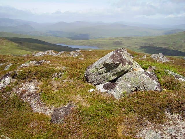
Creag Loch nan Dearcag — crag of the loch of the little berries — reaches 537m at NH 333 567 between Strathconon and Strathgarve. A small lochan on the eastern shoulder gives the hill its name, with crowberry and blaeberry thick on the surrounding ground in late summer.
Quick facts
- Height
- 537m/ 1762ft
- Prominence
- 232 m
- Grid ref
- NH 33340 56723
- Nearest city
- Inverness· 35km
- Dogs
- Dogs on lead required near livestockDog-friendly guide ↗
Height and prominence cross-checked against the Database of British and Irish Hills (CC BY).
No GPX track yet
Walked this route? Share your track to help other walkers.
Standard route
heather moorland 50% · rocky slopes 35% · grass slopes 15%
Approach from the Strathconon road near Strathanmore. A faint stalker's path leads onto the broad south ridge, then trackless heather climbs to the rocky summit. About 4 hours for the circuit.
Terrain
Tall heather lower down with hidden boulders — twisted ankles are the main hazard. Above 400m the ground opens into short grass and weathered schist outcrops scattered around the lochan and summit.
In winter
A mid-altitude hill where lying snow comes and goes through the winter. The boggy approach freezes hard which actually eases progress. Visibility on the broad summit dome demands careful compass work.
Best time of year
Getting there
- Glasgow5h 38m
- Edinburgh6h 53m
OS maps: OS Landranger 26, OS Explorer 437S
Mobile signal: Poor. Remote Wester Ross; all networks fail. A PLB is worth carrying.
Current conditions
Daylight Today
- Sunrise
- 05:10
- Sunset
- 21:41
- Civil dawn
- 04:17
- Civil dusk
- 22:34
NOAA Solar Calculator · 30 July 2026
Around Creag Loch nan Dearcag on the SCOT network
Getting there, basing yourself, and what to do off the hill.
Getting there: Dingwall station
Ben Wyvis approach; Easter Ross; junction for Kyle and Far North lines
22km from the hill
tripscot.co.uk
On TripSCOTBase yourself in Inverness
Highland capital — gateway to Cairngorms, Affric, Far North
35km from the hill
tripscot.co.uk
On TasteSCOTAfter the hill: Glen Ord
Muir of Ord — Black Isle distillery; the Singleton range's Highland anchor
21km from the hill
tastescot.co.uk
Creag Loch nan Dearcag — common questions
- How hard is Creag Loch nan Dearcag?
- We grade Creag Loch nan Dearcag at 2/5, which puts it in moderate territory. Terrain: Tall heather lower down with hidden boulders — twisted ankles are the main hazard.
- How prominent is Creag Loch nan Dearcag?
- Creag Loch nan Dearcag has 232m of topographic prominence — the height of its summit above the highest col connecting it to higher ground. Marilyns are defined by that measure: at least 150m of drop on all sides.
- When should I climb Creag Loch nan Dearcag?
- The standard good-weather months for Creag Loch nan Dearcag are March, April, May, June, July, August, September, October. Outside those months, expect winter conditions on the high ground — full mountain kit, navigation skills, and a check of the SAIS avalanche forecast for the relevant region.
- Can I bring my dog up Creag Loch nan Dearcag?
- On a lead only — the route crosses ground with livestock or nesting-bird interest.
- What's mobile reception like on Creag Loch nan Dearcag?
- Poor. Remote Wester Ross; all networks fail. A PLB is worth carrying.
- Is Creag Loch nan Dearcag safe in winter?
- A mid-altitude hill where lying snow comes and goes through the winter. The boggy approach freezes hard which actually eases progress. Visibility on the broad summit dome demands careful compass work.
Get the OutdoorSCOT weekly
One email a week — new route, hill and bothy guides, seasonal conditions and the odd hard-won lesson. No spam, unsubscribe in one click.