Marilyn · North-West Highlands
Cnoc Damh
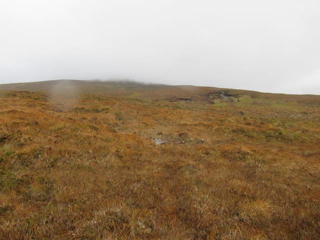
Cnoc Damh — knoll of the stag — is a 588m hill at NH 270 962 above Strath Oykel, midway between Oykel Bridge and Rosehall. The hill has been deer ground for centuries and the name reflects the rutting bellows that echo round its corrie every October.
Gaelic: “small hill, stag” · Pronunciation: k-nok dav
Quick facts
- Height
- 588m/ 1929ft
- Prominence
- 366 m
- Grid ref
- NH 27041 96221
- Nearest city
- Inverness· 64km
- Dogs
- Dogs on lead required near livestockDog-friendly guide ↗
Height and prominence cross-checked against the Database of British and Irish Hills (CC BY).
No GPX track yet
Walked this route? Share your track to help other walkers.
Standard route
heather and bog 65% · grass slopes 25% · rocky summit 10%
Best approached from the A837 at Tutim Burn, following the burn south-west onto open ground and tackling the east shoulder direct. There is no path; expect 3-4 hours up and down through heather and bog.
Terrain
Moine schist and the typical Sutherland mix of peat hag, heather and tussock grass. The summit is a broad grassy dome with a small cairn; lower down the burn gullies cut deeply into pink sandstone.
In winter
Far inland, the climate here is more continental than coastal — colder, drier and with longer-lying snow than hills nearer the west coast. Below 600m the cover is patchy; the deer stay high in cold weather and tracks are easy to spot in snow.
This hill is in the Torridon SAIS forecast area. Check SAIS forecasts in winter (December–April).
Best time of year
Getting there
- Glasgow6h 36m
- Edinburgh7h 47m
OS maps: OS Landranger 20, OS Explorer 439E
Mobile signal: Poor. No signal—Ben Klibreck / Strath Vagastie area is a well-known dead zone.
Current conditions
Daylight Today
- Sunrise
- 05:09
- Sunset
- 21:44
- Civil dawn
- 04:14
- Civil dusk
- 22:38
NOAA Solar Calculator · 30 July 2026
Around Cnoc Damh on the SCOT network
Getting there, basing yourself, and what to do off the hill.
Cnoc Damh — common questions
- What difficulty is Cnoc Damh?
- On the OutdoorSCOT scale, Cnoc Damh comes in at 2/5 — moderate. Underfoot: Moine schist and the typical Sutherland mix of peat hag, heather and tussock grass.
- What is Cnoc Damh's prominence?
- 366m of prominence. That's the vertical drop from the summit to the col that links Cnoc Damh to the next higher ground. That drop is what qualifies it as a Marilyn — a hill with at least 150m of descent on every side.
- When is the best time to climb Cnoc Damh?
- March, April, May, June, July, August, September, October give the most reliable conditions on Cnoc Damh. Beyond that window the high ground turns wintry: carry full mountain kit, be confident navigating, and check the SAIS avalanche forecast for the area.
- Is Cnoc Damh dog-friendly?
- Yes, but dogs must be kept on a lead — there is livestock or ground-nesting bird interest on the route.
- Is there mobile signal on Cnoc Damh?
- Poor. No signal—Ben Klibreck / Strath Vagastie area is a well-known dead zone.
- Is Cnoc Damh safe in winter?
- Far inland, the climate here is more continental than coastal — colder, drier and with longer-lying snow than hills nearer the west coast. Below 600m the cover is patchy; the deer stay high in cold weather and tracks are easy to spot in snow.
Get the OutdoorSCOT weekly
One email a week — new route, hill and bothy guides, seasonal conditions and the odd hard-won lesson. No spam, unsubscribe in one click.