Munro · Cairngorms
An Sgarsoch
An Sgarsoch (1006m) is one of the most remote Munros in Scotland — a broad mossy summit standing on the watershed between Glen Feshie, Glen Tilt and the Geldie river. The name means "the place of sharp rocks" though the hill itself is anything but sharp. Historically a cattle drovers' tryst site (the great Sgarsoch fair) — there are still remains of stone-built drovers' shielings near the summit. Always paired with its near-twin Càrn an Fhìdhleir on a long expedition through some of the wildest country in Scotland.
Quick facts
- Height
- 1006.5m/ 3302ft
- Prominence
- 319 m
- Distance
- 17 km
- Ascent
- 886 m
- Time
- 5–8 hrs
- Grid ref
- NN933836
- Parking
- NO062898
- Nearest
- Perth· Inverness 67km
- Dogs
- Dogs on lead required near livestockDog-friendly guide ↗
Height and prominence cross-checked against the Database of British and Irish Hills (CC BY).
No GPX track yet
Walked this route? Share your track to help other walkers.
Standard route
Glen track 50% · Open moorland 35% · Summit 15%
The most efficient approach is from Linn of Dee (NTS) — cycle west up the Geldie track to the disused White Bridge ruins (around 9km), then climb the broad north-east slope of An Sgarsoch directly. Traverse west to Càrn an Fhìdhleir, returning across the broad bealach and the same Geldie track. Alternatively a multi-day walk-in from Blair Atholl via Glen Tilt and the Feith Uaine bothy. Round-trip from Linn of Dee with bike is 32km with 800m of ascent.
Terrain
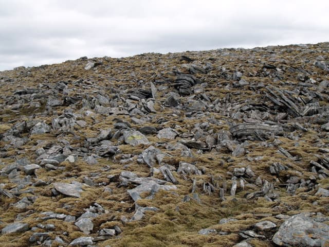
The Geldie estate landrover track is firm and ideal for bikes for the long approach. The Geldie water crossings (Geldie Burn and Bynack Burn) can be impassable after rain — assess before committing. Off the tracks the going is rough wet heather and peat hags. The summit area is a vast featureless mossy plateau with a small cairn — a serious navigation challenge in cloud. The bealach to Càrn an Fhìdhleir is broad and boggy.
In winter
A genuinely remote winter Munro day. The Linn of Dee road can sometimes drift but is usually open. The Geldie crossings can be unfordable after snowmelt or in spate. The vast featureless summits are exposed to easterly continental winds and accumulate deep drifts. Phone signal absent throughout the day. SAIS Southern Cairngorms is the closest official forecast. Self-sufficient winter navigation essential.
This hill is in the Northern Cairngorms SAIS forecast area. Check SAIS forecasts in winter (December–April).
Best time of year
Getting there
- Glasgow3h 37m
- Edinburgh2h 26m
OS maps: OS Landranger 43
Mobile signal: No signal whatsoever. As remote as any of the Munros in Scotland. Linn of Dee is the last point with any coverage. Download Harvey Cairngorms before leaving Braemar.
Current conditions
Daylight Today
- Sunrise
- 04:57
- Sunset
- 21:46
- Civil dawn
- 04:01
- Civil dusk
- 22:42
NOAA Solar Calculator · 23 July 2026
Pair with
Curated multi-hill combinations from An Sgarsoch.
Around An Sgarsoch on the SCOT network
Getting there, basing yourself, and what to do off the hill.
Getting there: Blair Atholl station
Beinn a Ghlo; Glen Tilt corridor north to the Cairngorms
19km from the hill
tripscot.co.uk
On TripSCOTBase yourself in Pitlochry
Perthshire base — Schiehallion, Beinn a Ghlo, Ben Vrackie
25km from the hill
tripscot.co.uk
On TasteSCOTAfter the hill: Edradour
Pitlochry — until recently Scotland's smallest distillery; charming Perthshire setting
25km from the hill
tastescot.co.uk
An Sgarsoch — common questions
- What difficulty is An Sgarsoch?
- On the OutdoorSCOT scale, An Sgarsoch comes in at 4/5 — challenging. Expect roughly 17km and 886m of ascent on the usual route — 5-8 hours for most parties. Ground conditions: The Geldie estate landrover track is firm and ideal for bikes for the long approach.
- How much drop does An Sgarsoch have?
- The drop is 319m: measured from the summit of An Sgarsoch down to the saddle joining it to higher terrain.
- Where's the parking for An Sgarsoch?
- Park at NO062898 near Perth. Double-check the grid reference on an OS map first; informal laybys here fill early in high season.
- What's the best month to climb An Sgarsoch?
- Aim for May, June, July, August, September, October on An Sgarsoch. In the remaining months treat it as a winter hill — full kit, solid navigation, and a look at the relevant SAIS avalanche forecast before you go.
- Can dogs go up An Sgarsoch?
- Dogs are fine on a lead. The route passes livestock or ground-nesting bird habitat, so keep them close throughout.
- Will I get phone signal on An Sgarsoch?
- No signal whatsoever. As remote as any of the Munros in Scotland. Linn of Dee is the last point with any coverage. Download Harvey Cairngorms before leaving Braemar.
- Is An Sgarsoch safe in winter?
- A genuinely remote winter Munro day. The Linn of Dee road can sometimes drift but is usually open. The Geldie crossings can be unfordable after snowmelt or in spate. The vast featureless summits are exposed to easterly continental winds and accumulate deep drifts. Phone signal absent throughout the day. SAIS Southern Cairngorms is the closest official forecast. Self-sufficient winter navigation essential.
Get the OutdoorSCOT weekly
One email a week — new route, hill and bothy guides, seasonal conditions and the odd hard-won lesson. No spam, unsubscribe in one click.