Marilyn · Argyll
Stob Odhar
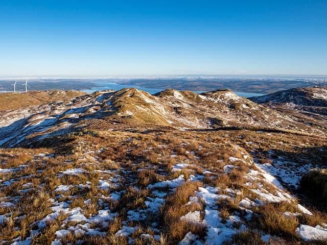
Stob Odhar, the Dun-coloured Peak, reaches 562m in the rolling Cowal hills west of Loch Fyne. It is one of the more elusive Marilyns of the region thanks to dense forestry on every approach.
Quick facts
- Height
- 562m/ 1844ft
- Prominence
- 542 m
- Grid ref
- NR 81887 74220
- Nearest city
- Glasgow· 78km
- Dogs
- Dogs on lead required near livestockDog-friendly guide ↗
Height and prominence cross-checked against the Database of British and Irish Hills (CC BY).
No GPX track yet
Walked this route? Share your track to help other walkers.
Standard route
heather and bog 60% · rocky slopes 25% · grass slopes 15%
Start from Kilmichael Glassary or the Lochgair side and weave a route via forest roads onto open ridge. Map work is essential; allow three to four hours for the round.
Terrain
Long sections of forest track preface boggy felled clearings and tussocky upper ground. Recent windblow can make some lines tedious to thread.
In winter
Modest snow cover possible in cold snaps but it seldom lingers. Frozen ground is genuinely helpful here as the bogs are abundant.
Best time of year
Getting there
- Glasgow3h 13m
- Edinburgh6h 57m
OS maps: OS Landranger 62, OS Explorer 358S
Mobile signal: Poor. Remote Cowal or Argyll hill; EE and Vodafone both fail here.
Current conditions
Daylight Today
- Sunrise
- 05:22
- Sunset
- 21:35
- Civil dawn
- 04:33
- Civil dusk
- 22:24
NOAA Solar Calculator · 30 July 2026
Around Stob Odhar on the SCOT network
Getting there, basing yourself, and what to do off the hill.
Getting there: Wemyss Bay station
Ferry to Rothesay (Isle of Bute) — West Island Way start
38km from the hill
tripscot.co.uk
On TripSCOTBase yourself in Rothesay
Isle of Bute base; West Island Way; short Glasgow break
28km from the hill
tripscot.co.uk
On TasteSCOTAfter the hill: Arran
Lochranza — northern Arran; revived in 1995; rich sherried releases
26km from the hill
tastescot.co.uk
Stob Odhar — common questions
- Is Stob Odhar a hard climb?
- Stob Odhar is rated 2/5 (moderate) on the OutdoorSCOT scale. Underfoot: Long sections of forest track preface boggy felled clearings and tussocky upper ground.
- What is Stob Odhar's prominence?
- 542m of prominence. That's the vertical drop from the summit to the col that links Stob Odhar to the next higher ground. That drop is what qualifies it as a Marilyn — a hill with at least 150m of descent on every side.
- When is the best time to climb Stob Odhar?
- March, April, May, June, July, August, September, October give the most reliable conditions on Stob Odhar. Beyond that window the high ground turns wintry: carry full mountain kit, be confident navigating, and check the SAIS avalanche forecast for the area.
- Is Stob Odhar dog-friendly?
- Yes, but dogs must be kept on a lead — there is livestock or ground-nesting bird interest on the route.
- Is there mobile signal on Stob Odhar?
- Poor. Remote Cowal or Argyll hill; EE and Vodafone both fail here.
- Is Stob Odhar safe in winter?
- Modest snow cover possible in cold snaps but it seldom lingers. Frozen ground is genuinely helpful here as the bogs are abundant.
Get the OutdoorSCOT weekly
One email a week — new route, hill and bothy guides, seasonal conditions and the odd hard-won lesson. No spam, unsubscribe in one click.