Marilyn · Argyll
Cruach Lusach
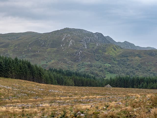
Cruach Lusach is a 466m wooded hill in mid-Argyll between Loch Awe and Loch Fyne. The Gaelic name suggests a herb-rich top and the surrounding Knapdale forests are renowned for their Atlantic oak fragments.
Quick facts
- Height
- 466.8m/ 1531ft
- Prominence
- 280 m
- Grid ref
- NR 78606 83210
- Nearest city
- Oban· 47km
- Dogs
- Dogs on lead required near livestockDog-friendly guide ↗
Height and prominence cross-checked against the Database of British and Irish Hills (CC BY).
No GPX track yet
Walked this route? Share your track to help other walkers.
Standard route
heather and bog 60% · herb-rich grassland 25% · rocky summit 15%
Forestry tracks from the B840 near Ford give the cleanest line, finishing across rougher upland to the cairn. About three hours up and down at a relaxed pace.
Terrain
A mix of solid forest road, soft replanted clearings and damp summit pasture. Watch for brash and old stumps in cleared areas.
In winter
Light snow may settle briefly. Short daylight is more limiting than conditions on the ground.
Best time of year
Getting there
- Glasgow3h 23m
- Edinburgh6h 7m
OS maps: OS Landranger 55, OS Explorer 358S
Mobile signal: Poor. Signal drops on the glen approach; all networks fail at summit.
Current conditions
Daylight Today
- Sunrise
- 05:22
- Sunset
- 21:35
- Civil dawn
- 04:33
- Civil dusk
- 22:25
NOAA Solar Calculator · 30 July 2026
Around Cruach Lusach on the SCOT network
Getting there, basing yourself, and what to do off the hill.
Cruach Lusach — common questions
- How hard is Cruach Lusach?
- We grade Cruach Lusach at 1/5, which puts it in easy territory. Terrain: A mix of solid forest road, soft replanted clearings and damp summit pasture.
- How prominent is Cruach Lusach?
- Cruach Lusach has 280m of topographic prominence — the height of its summit above the highest col connecting it to higher ground. Marilyns are defined by that measure: at least 150m of drop on all sides.
- When should I climb Cruach Lusach?
- The standard good-weather months for Cruach Lusach are March, April, May, June, July, August, September, October. Outside those months, expect winter conditions on the high ground — full mountain kit, navigation skills, and a check of the SAIS avalanche forecast for the relevant region.
- Can I bring my dog up Cruach Lusach?
- On a lead only — the route crosses ground with livestock or nesting-bird interest.
- What's mobile reception like on Cruach Lusach?
- Poor. Signal drops on the glen approach; all networks fail at summit.
- Is Cruach Lusach safe in winter?
- Light snow may settle briefly. Short daylight is more limiting than conditions on the ground.
Get the OutdoorSCOT weekly
One email a week — new route, hill and bothy guides, seasonal conditions and the odd hard-won lesson. No spam, unsubscribe in one click.