Marilyn · Argyll
Beinn Bhan
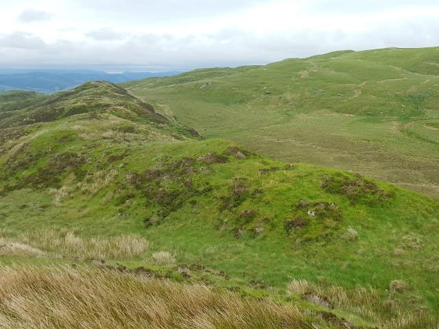
This 319m Beinn Bhan (White Hill) stands on the Kintyre peninsula near Skipness, looking across Kilbrannan Sound to Arran. Its pale grass crown picks out the name in bright weather.
Gaelic: “mountain, fair” · Pronunciation: bine vahn
Quick facts
- Height
- 319m/ 1047ft
- Prominence
- 241 m
- Grid ref
- NR 85688 99802
- Nearest city
- Oban· 30km
- Dogs
- Dogs on lead required near livestockDog-friendly guide ↗
Height and prominence cross-checked against the Database of British and Irish Hills (CC BY).
No GPX track yet
Walked this route? Share your track to help other walkers.
Standard route
heather and bog 65% · grass slopes 25% · rocky summit 10%
Walks usually start from the B8001 near Skipness, following minor tracks before climbing pathless heather and grass to the summit. About 2 to 3 hours suffices for the round.
Terrain
Sheep-cropped grass and short heather make up most of the hill, with a few low schist outcrops near the top. Drier underfoot than many mid-Argyll Marilyns.
In winter
Atlantic-mild for most of winter but the exposed summit catches strong westerlies straight off the sea. Snow rarely lies more than briefly.
Best time of year
Getting there
- Glasgow3h 11m
- Edinburgh6h 52m
OS maps: OS Landranger 55, OS Explorer 358N, OS Explorer 360S
Mobile signal: Poor. Remote Argyll/Cowal; limited coverage.
Current conditions
Daylight Today
- Sunrise
- 05:21
- Sunset
- 21:36
- Civil dawn
- 04:31
- Civil dusk
- 22:25
NOAA Solar Calculator · 30 July 2026
Around Beinn Bhan on the SCOT network
Getting there, basing yourself, and what to do off the hill.
Beinn Bhan — common questions
- What difficulty is Beinn Bhan?
- On the OutdoorSCOT scale, Beinn Bhan comes in at 1/5 — easy. Ground conditions: Sheep-cropped grass and short heather make up most of the hill, with a few low schist outcrops near the top.
- How much drop does Beinn Bhan have?
- The drop is 241m: measured from the summit of Beinn Bhan down to the saddle joining it to higher terrain. Passing the 150m-drop threshold on all sides is exactly what makes it a Marilyn.
- What's the best month to climb Beinn Bhan?
- Aim for March, April, May, June, July, August, September, October on Beinn Bhan. In the remaining months treat it as a winter hill — full kit, solid navigation, and a look at the relevant SAIS avalanche forecast before you go.
- Can dogs go up Beinn Bhan?
- Dogs are fine on a lead. The route passes livestock or ground-nesting bird habitat, so keep them close throughout.
- Will I get phone signal on Beinn Bhan?
- Poor. Remote Argyll/Cowal; limited coverage.
- Is Beinn Bhan safe in winter?
- Atlantic-mild for most of winter but the exposed summit catches strong westerlies straight off the sea. Snow rarely lies more than briefly.
Get the OutdoorSCOT weekly
One email a week — new route, hill and bothy guides, seasonal conditions and the odd hard-won lesson. No spam, unsubscribe in one click.