Marilyn · Argyll & Bute
Cnoc nam Broighleag
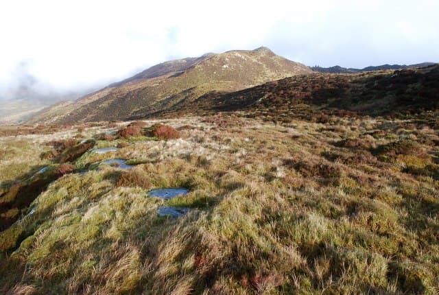
Cnoc nam Broighleag — the Knoll of the Blaeberries — is a 314m Marilyn on the Cowal peninsula, where carpets of blaeberry plants give the late-summer slopes a faintly purple tinge.
Quick facts
- Height
- 314m/ 1030ft
- Prominence
- 160 m
- Grid ref
- NR 94013 93723
- Nearest city
- Oban· 37km
- Dogs
- Dogs on lead required near livestockDog-friendly guide ↗
Height and prominence cross-checked against the Database of British and Irish Hills (CC BY).
No GPX track yet
Walked this route? Share your track to help other walkers.
Standard route
heather and bog 65% · grass slopes 25% · rocky summit 10%
Quiet forestry roads from the B836 near the Loch Striven shore give the most reliable approach. Above the trees a short pull on heather gains the summit; reckon on 2 to 3 hours for the round.
Terrain
Plantation tracks, mossy clear-fell ground and a final heather-and-blaeberry summit dome. The going is wetter than it looks on the map.
In winter
Forest tracks can be sheets of ice in cold weather; the open hill is usually free of lying snow but exposed to gales. A short day suits this hill in midwinter daylight.
Best time of year
Getting there
- Glasgow3h 49m
- Edinburgh6h 30m
OS maps: OS Landranger 55, OS Explorer 358N, OS Explorer 362N
Mobile signal: Poor. No provider covers this remote summit. GPS tracker recommended.
Current conditions
Daylight Today
- Sunrise
- 06:50
- Sunset
- 19:44
- Civil dawn
- 06:12
- Civil dusk
- 20:22
NOAA Solar Calculator · 14 September 2026
Around Cnoc nam Broighleag on the SCOT network
Getting there, basing yourself, and what to do off the hill.
Cnoc nam Broighleag — common questions
- Is Cnoc nam Broighleag a hard climb?
- Cnoc nam Broighleag is rated 1/5 (easy) on the OutdoorSCOT scale. Ground conditions: Plantation tracks, mossy clear-fell ground and a final heather-and-blaeberry summit dome.
- How much drop does Cnoc nam Broighleag have?
- The drop is 160m: measured from the summit of Cnoc nam Broighleag down to the saddle joining it to higher terrain. Passing the 150m-drop threshold on all sides is exactly what makes it a Marilyn.
- What's the best month to climb Cnoc nam Broighleag?
- Aim for March, April, May, June, July, August, September, October on Cnoc nam Broighleag. In the remaining months treat it as a winter hill — full kit, solid navigation, and a look at the relevant SAIS avalanche forecast before you go.
- Can dogs go up Cnoc nam Broighleag?
- Dogs are fine on a lead. The route passes livestock or ground-nesting bird habitat, so keep them close throughout.
- Will I get phone signal on Cnoc nam Broighleag?
- Poor. No provider covers this remote summit. GPS tracker recommended.
- Is Cnoc nam Broighleag safe in winter?
- Forest tracks can be sheets of ice in cold weather; the open hill is usually free of lying snow but exposed to gales. A short day suits this hill in midwinter daylight.
Get the OutdoorSCOT weekly
One email a week — new route, hill and bothy guides, seasonal conditions and the odd hard-won lesson. No spam, unsubscribe in one click.