Sub-Marilyn · Argyll & Bute
Stob na Boine Druim-fhinn
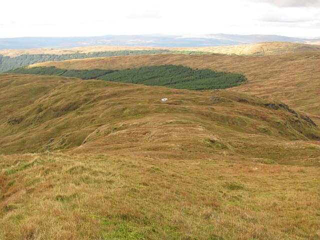
Stob na Boine Druim-fhinn, the Peak of Find's White Ridge, rises to 658m in the Argyll Forest Park behind Lochgoilhead. Folk tradition links the name to the Fianna warrior bands of Gaelic legend.
Quick facts
- Height
- 658.4m/ 2160ft
- Prominence
- 150 m
- Grid ref
- NN 16883 02530
- Nearest city
- Oban· 41km
- Dogs
- Dogs on lead required near livestockDog-friendly guide ↗
Sub-Marilyn: the drop rounds to 150m, but DoBIH measures it a fraction under the Marilyn cut. We keep it on the list as a near-miss.
Height and prominence cross-checked against the Database of British and Irish Hills (CC BY).
No GPX track yet
Walked this route? Share your track to help other walkers.
Standard route
heather moorland 65% · grass slopes 25% · rocky summit 10%
From Lochgoilhead, forest roads climb steadily before walkers strike up onto the open south ridge. About four to five hours for the round.
Terrain
Long forestry approach, then steep grass and heather flanks. The ridge itself is grassy with scattered crags on either side.
In winter
Snow lies more readily here than on lower Argyll hills. Crampons and axe are sensible above 500m in genuine winter conditions.
Best time of year
Getting there
- Glasgow2h 59m
- Edinburgh5h 36m
OS maps: OS Landranger 56, OS Explorer 0037N, OS Explorer 363N
Mobile signal: Poor. Remote Knapdale/Kintyre; limited coverage.
Current conditions
Daylight Today
- Sunrise
- 06:49
- Sunset
- 19:42
- Civil dawn
- 06:11
- Civil dusk
- 20:20
NOAA Solar Calculator · 14 September 2026
Around Stob na Boine Druim-fhinn on the SCOT network
Getting there, basing yourself, and what to do off the hill.
Stob na Boine Druim-fhinn — common questions
- What difficulty is Stob na Boine Druim-fhinn?
- On the OutdoorSCOT scale, Stob na Boine Druim-fhinn comes in at 2/5 — moderate. Terrain: Long forestry approach, then steep grass and heather flanks.
- How prominent is Stob na Boine Druim-fhinn?
- Stob na Boine Druim-fhinn has 150m of topographic prominence — the height of its summit above the highest col connecting it to higher ground. That rounds to 150m, but DoBIH measures the drop a fraction under the Marilyn threshold — it's classed a sub-Marilyn, a near-miss rather than a full Marilyn.
- When should I climb Stob na Boine Druim-fhinn?
- The standard good-weather months for Stob na Boine Druim-fhinn are March, April, May, June, July, August, September, October. Outside those months, expect winter conditions on the high ground — full mountain kit, navigation skills, and a check of the SAIS avalanche forecast for the relevant region.
- Can I bring my dog up Stob na Boine Druim-fhinn?
- On a lead only — the route crosses ground with livestock or nesting-bird interest.
- What's mobile reception like on Stob na Boine Druim-fhinn?
- Poor. Remote Knapdale/Kintyre; limited coverage.
- Is Stob na Boine Druim-fhinn safe in winter?
- Snow lies more readily here than on lower Argyll hills. Crampons and axe are sensible above 500m in genuine winter conditions.
Get the OutdoorSCOT weekly
One email a week — new route, hill and bothy guides, seasonal conditions and the odd hard-won lesson. No spam, unsubscribe in one click.