Marilyn · Argyll
Beinn Lagan
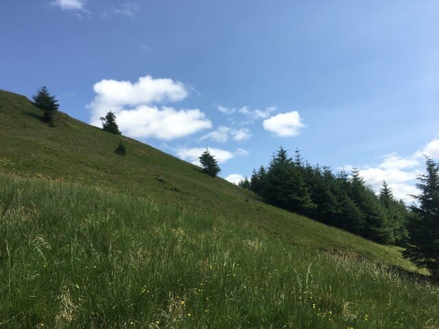
Beinn Lagan rises sharply from the eastern shore of Loch Fyne at 465m. Despite its modest stature the hill provides a quick steep workout with excellent views down the loch toward the Cowal hills and Arran beyond.
Quick facts
- Height
- 465m/ 1526ft
- Prominence
- 243 m
- Grid ref
- NS 11994 99654
- Nearest city
- Oban· 40km
- Dogs
- Dogs on lead required near livestockDog-friendly guide ↗
Height and prominence cross-checked against the Database of British and Irish Hills (CC BY).
No GPX track yet
Walked this route? Share your track to help other walkers.
Standard route
heather moorland 65% · grass slopes 25% · rocky summit 10%
Park near Strachur and follow forestry tracks east before breaking onto open ground for the final climb. The going is rough but the route is fairly direct. Round trip of around 3 hours.
Terrain
Steep grass and bracken on the lower slopes give way to heather, with rocky outcrops near the summit. Some sections of forestry brash where felling has taken place.
In winter
Snow lies briefly on the upper slopes from December to February. Frozen ground can actually make the going easier than in summer. No technical equipment needed.
Best time of year
Getting there
- Glasgow2h 9m
- Edinburgh5h 47m
OS maps: OS Landranger 56, OS Explorer 0037N, OS Explorer 363N
Mobile signal: Moderate. EE workable near Strachur road; signal patchy on upper slopes.
Current conditions
Daylight Today
- Sunrise
- 05:19
- Sunset
- 21:34
- Civil dawn
- 04:29
- Civil dusk
- 22:24
NOAA Solar Calculator · 30 July 2026
Around Beinn Lagan on the SCOT network
Getting there, basing yourself, and what to do off the hill.
Beinn Lagan — common questions
- How difficult is Beinn Lagan?
- Beinn Lagan carries a 1/5 (easy) grade on the OutdoorSCOT scale. Underfoot: Steep grass and bracken on the lower slopes give way to heather, with rocky outcrops near the summit.
- What is Beinn Lagan's prominence?
- 243m of prominence. That's the vertical drop from the summit to the col that links Beinn Lagan to the next higher ground. That drop is what qualifies it as a Marilyn — a hill with at least 150m of descent on every side.
- When is the best time to climb Beinn Lagan?
- March, April, May, June, July, August, September, October give the most reliable conditions on Beinn Lagan. Beyond that window the high ground turns wintry: carry full mountain kit, be confident navigating, and check the SAIS avalanche forecast for the area.
- Is Beinn Lagan dog-friendly?
- Yes, but dogs must be kept on a lead — there is livestock or ground-nesting bird interest on the route.
- Is there mobile signal on Beinn Lagan?
- Moderate. EE workable near Strachur road; signal patchy on upper slopes.
- Is Beinn Lagan safe in winter?
- Snow lies briefly on the upper slopes from December to February. Frozen ground can actually make the going easier than in summer. No technical equipment needed.
Get the OutdoorSCOT weekly
One email a week — new route, hill and bothy guides, seasonal conditions and the odd hard-won lesson. No spam, unsubscribe in one click.