Marilyn · Argyll & Bute
Speinne Mor
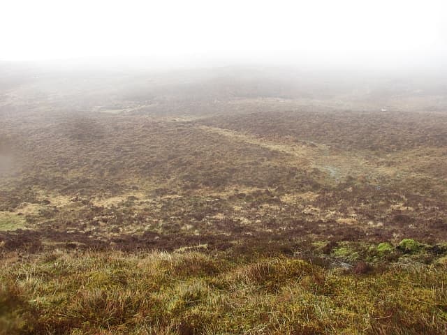
Speinne Mor is a 446m summit on the road that links Salen to Calgary across the northern arm of Mull. It is the highest point on the north of the island and the panorama from the top takes in Ardnamurchan, the Small Isles and the whole length of Loch na Keal.
Gaelic: “big” · Pronunciation: speinne more
Quick facts
- Height
- 446m/ 1463ft
- Prominence
- 410 m
- Grid ref
- NM 49940 49776
- Nearest city
- Oban· 41km
- Dogs
- Dogs on lead required near livestockDog-friendly guide ↗
Height and prominence cross-checked against the Database of British and Irish Hills (CC BY).
No GPX track yet
Walked this route? Share your track to help other walkers.
Standard route
heather and bog 65% · grass slopes 25% · rocky summit 10%
Park at the high point of the B8073 between Loch Frisa and the Calgary road and head east up the open hillside. The line is short and direct, no more than 90 minutes to the summit, with a clear ATV track helping for the first kilometre.
Terrain
Short heather and cropped grass with the help of a forestry-era ATV track for the lower part of the climb. Above the track the going is firm with very little bog.
In winter
One of the most accessible Mull tops in winter thanks to its short approach from a well-driven road. Snow rarely amounts to more than a dusting and the summit is generally walkable in any season.
Best time of year
Getting there
- Glasgow5h 4m
- Edinburgh8h 38m
Ferry access
Oban → Craignure
- Crossing time45 min
- Summer sailingsUp to 8 sailings daily (Apr–Oct)
- Winter sailings4–5 sailings daily (Nov–Mar)
- Book ahead7 days
- Last ferry backCheck CalMac timetable — sailings run until ~21:00 in peak summer
Foot passengers can usually turn up without booking. Book vehicle spaces in advance. The Lochaline → Fishnish crossing (15 min) is shorter but serves east Mull only.
Book on CalMac ↗OS maps: OS Landranger 47, OS Landranger 48, OS Explorer 374E
Mobile signal: Poor. Dead zone; signal returns near the main Craignure road.
Current conditions
Daylight Today
- Sunrise
- 05:21
- Sunset
- 21:41
- Civil dawn
- 04:30
- Civil dusk
- 22:31
NOAA Solar Calculator · 30 July 2026
Around Speinne Mor on the SCOT network
Getting there, basing yourself, and what to do off the hill.
Getting there: Oban station
Argyll ferry hub; Mull, Lismore, Coll, Tiree, Barra connections
41km from the hill
tripscot.co.uk
On TripSCOTBase yourself in Tobermory
Mull base — Ben More, Treshnish, ferry to Iona
6km from the hill
tripscot.co.uk
On TasteSCOTAfter the hill: Tobermory
Mull — colourful harbour-front distillery making both unpeated and peated (Ledaig) whisky
6km from the hill
tastescot.co.uk
Speinne Mor — common questions
- How hard is Speinne Mor?
- We grade Speinne Mor at 1/5, which puts it in easy territory. Terrain: Short heather and cropped grass with the help of a forestry-era ATV track for the lower part of the climb.
- How prominent is Speinne Mor?
- Speinne Mor has 410m of topographic prominence — the height of its summit above the highest col connecting it to higher ground. Marilyns are defined by that measure: at least 150m of drop on all sides.
- When should I climb Speinne Mor?
- The standard good-weather months for Speinne Mor are March, April, May, June, July, August, September, October. Outside those months, expect winter conditions on the high ground — full mountain kit, navigation skills, and a check of the SAIS avalanche forecast for the relevant region.
- Can I bring my dog up Speinne Mor?
- On a lead only — the route crosses ground with livestock or nesting-bird interest.
- What's mobile reception like on Speinne Mor?
- Poor. Dead zone; signal returns near the main Craignure road.
- How do I get the ferry to Speinne Mor?
- Oban → Craignure. Up to 8 sailings daily (Apr–Oct) in summer; 4–5 sailings daily (Nov–Mar) in winter. Book at least 7 days ahead. Foot passengers can usually turn up without booking. Book vehicle spaces in advance. The Lochaline → Fishnish crossing (15 min) is shorter but serves east Mull only.
- Is Speinne Mor safe in winter?
- One of the most accessible Mull tops in winter thanks to its short approach from a well-driven road. Snow rarely amounts to more than a dusting and the summit is generally walkable in any season.
Get the OutdoorSCOT weekly
One email a week — new route, hill and bothy guides, seasonal conditions and the odd hard-won lesson. No spam, unsubscribe in one click.