Marilyn · Skye & The Small Isles
Sithean a' Bhealaich Chumhaing
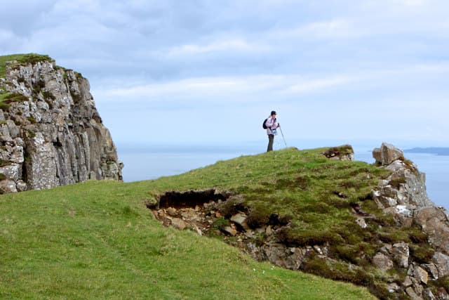
Sithean a' Bhealaich Chumhaing — the Fairy Mound of the Narrow Pass — overlooks the village of Holm just north of Portree on the eastern flank of the Trotternish Ridge. The NG 50 46 grid sits above the dramatic Bealach Chumhaing landslip terrace, where the basalt cliffs drop in tiers to the Sound of Raasay.
Quick facts
- Height
- 393m/ 1289ft
- Prominence
- 235 m
- Grid ref
- NG 50897 46616
- Dogs
- Dogs on lead required near livestockDog-friendly guide ↗
Height and prominence cross-checked against the Database of British and Irish Hills (CC BY).
No GPX track yet
Walked this route? Share your track to help other walkers.
Standard route
heather moorland 50% · rocky slopes 35% · grass slopes 15%
From Holm (NG 49 47) follow the rough track inland onto the lower terraces, then climb the heathery west flank to the rounded summit. The east edge gives dizzying views down to the sea. Around 6 km return with 350m of climb.
Terrain
A landslip landscape of grassy benches and tumbled basalt blocks, with no continuous path. The summit itself is broad turf but the east cliffs lie close, hidden by overhanging grass.
In winter
East-facing crags accumulate verglas after rain-freeze and cornices form on the cliff edge. Snow rarely lies on the lower terraces but the upper bealach holds drift.
Best time of year
Getting there
- Glasgow6h 24m
- Edinburgh9h 35m
OS maps: OS Landranger 23, OS Landranger 24, OS Explorer 409, OS Explorer 410
Mobile signal: Poor. Dead zone; signal returns near the A87 or Portree.
Current conditions
Daylight Today
- Sunrise
- 06:52
- Sunset
- 19:49
- Civil dawn
- 06:13
- Civil dusk
- 20:28
NOAA Solar Calculator · 14 September 2026
Around Sithean a' Bhealaich Chumhaing on the SCOT network
Getting there, basing yourself, and what to do off the hill.
Getting there: Kyle of Lochalsh station
Skye Bridge; Five Sisters of Kintail; Glen Shiel; Plockton
32km from the hill
tripscot.co.uk
On TripSCOTBase yourself in Portree
Main Skye base — Cuillin, Trotternish, Storr
4km from the hill
tripscot.co.uk
On TasteSCOTAfter the hill: Isle of Raasay Distillery
Raasay — new island distillery with rooms; Dun Caan walks from the door
11km from the hill
tastescot.co.uk
Sithean a' Bhealaich Chumhaing — common questions
- How hard is Sithean a' Bhealaich Chumhaing?
- We grade Sithean a' Bhealaich Chumhaing at 1/5, which puts it in easy territory. Underfoot: A landslip landscape of grassy benches and tumbled basalt blocks, with no continuous path.
- What is Sithean a' Bhealaich Chumhaing's prominence?
- 235m of prominence. That's the vertical drop from the summit to the col that links Sithean a' Bhealaich Chumhaing to the next higher ground. That drop is what qualifies it as a Marilyn — a hill with at least 150m of descent on every side.
- When is the best time to climb Sithean a' Bhealaich Chumhaing?
- March, April, May, June, July, August, September, October give the most reliable conditions on Sithean a' Bhealaich Chumhaing. Beyond that window the high ground turns wintry: carry full mountain kit, be confident navigating, and check the SAIS avalanche forecast for the area.
- Is Sithean a' Bhealaich Chumhaing dog-friendly?
- Yes, but dogs must be kept on a lead — there is livestock or ground-nesting bird interest on the route.
- Is there mobile signal on Sithean a' Bhealaich Chumhaing?
- Poor. Dead zone; signal returns near the A87 or Portree.
- Is Sithean a' Bhealaich Chumhaing safe in winter?
- East-facing crags accumulate verglas after rain-freeze and cornices form on the cliff edge. Snow rarely lies on the lower terraces but the upper bealach holds drift.
Get the OutdoorSCOT weekly
One email a week — new route, hill and bothy guides, seasonal conditions and the odd hard-won lesson. No spam, unsubscribe in one click.