Marilyn · Skye
Ben Dearg
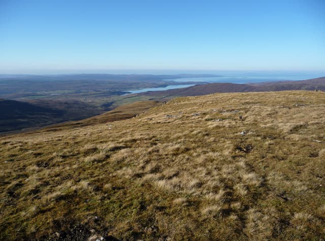
This Ben Dearg sits a few kilometres north of the iconic Old Man of Storr on the Trotternish escarpment. The NG 47 50 grid puts the summit on the same north-south spine but on the southern half of the ridge, with steep eastern crags facing the Sound of Raasay.
Gaelic: “mountain, red” · Pronunciation: ben jerr-ak
Quick facts
- Height
- 552m/ 1811ft
- Prominence
- 221 m
- Grid ref
- NG 47840 50412
- Dogs
- Dogs on lead required near livestockDog-friendly guide ↗
Height and prominence cross-checked against the Database of British and Irish Hills (CC BY).
No GPX track yet
Walked this route? Share your track to help other walkers.
Standard route
heather moorland 45% · rocky slopes 40% · grass slopes 15%
From the Storr car park (NG 50 53) follow the tourist path past the pinnacles before peeling off north-west up grassy slopes to gain the ridge. The summit lies a short walk north along the cliff-top. Around 11 km return with 620m of climb.
Terrain
Once off the Storr tourist trail the path fades to grass and peat with occasional outcrops. The eastern cliff edge is undercut in places — keep well clear in cloud or strong wind.
In winter
A combination of sea-level base and high east-facing crags gives this section of Trotternish unusual rime ice formations. Cornice build-up after easterly storms is significant and well documented.
Best time of year
Getting there
- Glasgow7h 34m
- Edinburgh9h 45m
OS maps: OS Landranger 23, OS Explorer 408, OS Explorer 409
Mobile signal: Poor. Remote Skye; coverage here is marginal.
Current conditions
Daylight Today
- Sunrise
- 05:17
- Sunset
- 21:46
- Civil dawn
- 04:23
- Civil dusk
- 22:39
NOAA Solar Calculator · 30 July 2026
Around Ben Dearg on the SCOT network
Getting there, basing yourself, and what to do off the hill.
Getting there: Kyle of Lochalsh station
Skye Bridge; Five Sisters of Kintail; Glen Shiel; Plockton
36km from the hill
tripscot.co.uk
On TripSCOTBase yourself in Portree
Main Skye base — Cuillin, Trotternish, Storr
7km from the hill
tripscot.co.uk
On TasteSCOTAfter the hill: Isle of Raasay Distillery
Raasay — new island distillery with rooms; Dun Caan walks from the door
15km from the hill
tastescot.co.uk
Ben Dearg — common questions
- Is Ben Dearg a hard climb?
- Ben Dearg is rated 2/5 (moderate) on the OutdoorSCOT scale. Underfoot: Once off the Storr tourist trail the path fades to grass and peat with occasional outcrops.
- What is Ben Dearg's prominence?
- 221m of prominence. That's the vertical drop from the summit to the col that links Ben Dearg to the next higher ground. That drop is what qualifies it as a Marilyn — a hill with at least 150m of descent on every side.
- When is the best time to climb Ben Dearg?
- March, April, May, June, July, August, September, October give the most reliable conditions on Ben Dearg. Beyond that window the high ground turns wintry: carry full mountain kit, be confident navigating, and check the SAIS avalanche forecast for the area.
- Is Ben Dearg dog-friendly?
- Yes, but dogs must be kept on a lead — there is livestock or ground-nesting bird interest on the route.
- Is there mobile signal on Ben Dearg?
- Poor. Remote Skye; coverage here is marginal.
- Is Ben Dearg safe in winter?
- A combination of sea-level base and high east-facing crags gives this section of Trotternish unusual rime ice formations. Cornice build-up after easterly storms is significant and well documented.
Get the OutdoorSCOT weekly
One email a week — new route, hill and bothy guides, seasonal conditions and the odd hard-won lesson. No spam, unsubscribe in one click.