Marilyn · Skye
Beinn na Greine
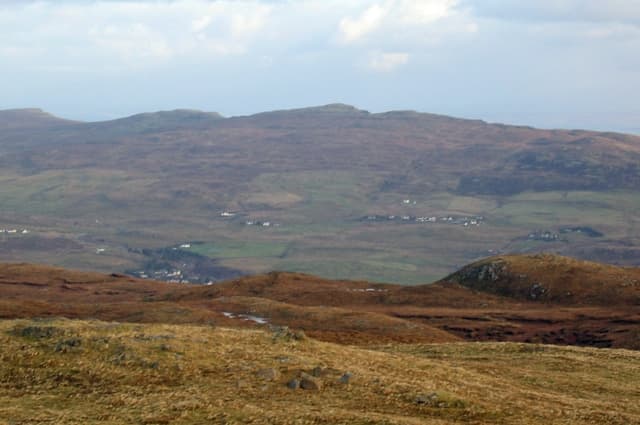
Beinn na Greine — the Hill of the Sun — sits inland from Portree on the watershed between Loch Snizort and Loch Portree. The NG 45 41 grid places it on the small upland between the A87 and the Trotternish foothills, with sweeping views over Skye's capital and east to Raasay.
Quick facts
- Height
- 417m/ 1368ft
- Prominence
- 266 m
- Grid ref
- NG 45966 41612
- Dogs
- Dogs on lead required near livestockDog-friendly guide ↗
Height and prominence cross-checked against the Database of British and Irish Hills (CC BY).
No GPX track yet
Walked this route? Share your track to help other walkers.
Standard route
heather moorland 60% · grass slopes 25% · rocky summit 15%
Park at the Storr Lochs road end (NG 47 45) or follow forest tracks from Borve (NG 45 48), then climb open hillside south-east onto the summit dome. The cairn looks down on Portree harbour and the Sound of Raasay. Around 7 km return with 380m of climb.
Terrain
A mixture of forestry edge, heather and short-cropped sheep pasture. The upper slopes are surprisingly dry compared with most Skye hills, but a few deep peat hollows lie south of the summit.
In winter
Low elevation and coastal position means snow rarely lies. The hill is exposed to gales sweeping in off Loch Snizort, and the lower forestry edge can be very muddy after rain.
Best time of year
Getting there
- Glasgow6h 29m
- Edinburgh9h 42m
OS maps: OS Landranger 23, OS Explorer 410
Mobile signal: Poor. Signal absent; inform a contact before heading out.
Current conditions
Daylight Today
- Sunrise
- 05:17
- Sunset
- 21:46
- Civil dawn
- 04:24
- Civil dusk
- 22:39
NOAA Solar Calculator · 30 July 2026
Around Beinn na Greine on the SCOT network
Getting there, basing yourself, and what to do off the hill.
Getting there: Kyle of Lochalsh station
Skye Bridge; Five Sisters of Kintail; Glen Shiel; Plockton
33km from the hill
tripscot.co.uk
On TripSCOTBase yourself in Portree
Main Skye base — Cuillin, Trotternish, Storr
3km from the hill
tripscot.co.uk
On TasteSCOTAfter the hill: Isle of Raasay Distillery
Raasay — new island distillery with rooms; Dun Caan walks from the door
10km from the hill
tastescot.co.uk
Beinn na Greine — common questions
- How hard is Beinn na Greine?
- We grade Beinn na Greine at 1/5, which puts it in easy territory. Terrain: A mixture of forestry edge, heather and short-cropped sheep pasture.
- How prominent is Beinn na Greine?
- Beinn na Greine has 266m of topographic prominence — the height of its summit above the highest col connecting it to higher ground. Marilyns are defined by that measure: at least 150m of drop on all sides.
- When should I climb Beinn na Greine?
- The standard good-weather months for Beinn na Greine are March, April, May, June, July, August, September, October. Outside those months, expect winter conditions on the high ground — full mountain kit, navigation skills, and a check of the SAIS avalanche forecast for the relevant region.
- Can I bring my dog up Beinn na Greine?
- On a lead only — the route crosses ground with livestock or nesting-bird interest.
- What's mobile reception like on Beinn na Greine?
- Poor. Signal absent; inform a contact before heading out.
- Is Beinn na Greine safe in winter?
- Low elevation and coastal position means snow rarely lies. The hill is exposed to gales sweeping in off Loch Snizort, and the lower forestry edge can be very muddy after rain.
Get the OutdoorSCOT weekly
One email a week — new route, hill and bothy guides, seasonal conditions and the odd hard-won lesson. No spam, unsubscribe in one click.