Marilyn · Skye
Roineval
Roineval lies in the centre of Skye between Bracadale and Glen Drynoch, a broad rounded moorland hill — not on Raasay despite the similar names. The NG 41 35 grid puts the summit on the lonely peat-haggy plateau that separates Skye's north and south, with distant views to both Cuillin ranges.
Quick facts
- Height
- 439m/ 1440ft
- Prominence
- 330 m
- Grid ref
- NG 41845 35047
- Dogs
- Dogs on lead required near livestockDog-friendly guide ↗
Height and prominence cross-checked against the Database of British and Irish Hills (CC BY).
No GPX track yet
Walked this route? Share your track to help other walkers.
Standard route
heather moorland 60% · grass slopes 25% · rocky summit 15%
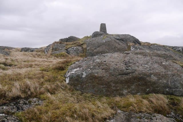
Park near the A863 at Roskhill (NG 40 45) or at the southern end of Loch Caroy (NG 36 43), then climb the long west ridge across deep heather and peat. The flat summit holds a small trig point. Around 10 km return with 410m of climb.
Terrain
Some of the worst peat hags on Skye — the broad summit plateau is heavily incised with channels of bare peat. Going is slow and tussocky throughout.
In winter
Frozen ground transforms the hags into easier walking but the broad plateau is a serious navigational problem in cloud. There are no landmarks, fences or watercourses to follow.
Best time of year
Getting there
- Glasgow7h 31m
- Edinburgh9h 47m
OS maps: OS Landranger 32, OS Explorer 410
Mobile signal: Poor. Remote Raasay; limited coverage.
Current conditions
Daylight Today
- Sunrise
- 05:18
- Sunset
- 21:46
- Civil dawn
- 04:25
- Civil dusk
- 22:38
NOAA Solar Calculator · 30 July 2026
Around Roineval on the SCOT network
Getting there, basing yourself, and what to do off the hill.
Getting there: Kyle of Lochalsh station
Skye Bridge; Five Sisters of Kintail; Glen Shiel; Plockton
35km from the hill
tripscot.co.uk
On TripSCOTBase yourself in Portree
Main Skye base — Cuillin, Trotternish, Storr
11km from the hill
tripscot.co.uk
On TasteSCOTAfter the hill: Talisker
Carbost on Skye — Cuillin foothills distillery; peppery, maritime, big-bodied
5km from the hill
tastescot.co.uk
Roineval — common questions
- What difficulty is Roineval?
- On the OutdoorSCOT scale, Roineval comes in at 1/5 — easy. Terrain: Some of the worst peat hags on Skye — the broad summit plateau is heavily incised with channels of bare peat.
- How prominent is Roineval?
- Roineval has 330m of topographic prominence — the height of its summit above the highest col connecting it to higher ground. Marilyns are defined by that measure: at least 150m of drop on all sides.
- When should I climb Roineval?
- The standard good-weather months for Roineval are March, April, May, June, July, August, September, October. Outside those months, expect winter conditions on the high ground — full mountain kit, navigation skills, and a check of the SAIS avalanche forecast for the relevant region.
- Can I bring my dog up Roineval?
- On a lead only — the route crosses ground with livestock or nesting-bird interest.
- What's mobile reception like on Roineval?
- Poor. Remote Raasay; limited coverage.
- Is Roineval safe in winter?
- Frozen ground transforms the hags into easier walking but the broad plateau is a serious navigational problem in cloud. There are no landmarks, fences or watercourses to follow.
Get the OutdoorSCOT weekly
One email a week — new route, hill and bothy guides, seasonal conditions and the odd hard-won lesson. No spam, unsubscribe in one click.