Marilyn · Skye
Ben Lee
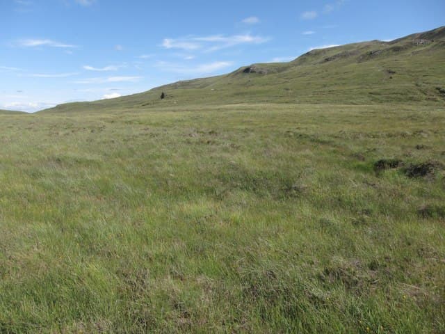
Ben Lee rises directly above the village of Peinchorran on Loch Sligachan, looking south across the loch to Marsco and the Red Hills. The NG 50 33 grid puts it on the small peninsula between Sligachan and Loch Ainort, with a famously good viewpoint over the eastern Cuillin.
Quick facts
- Height
- 444m/ 1457ft
- Prominence
- 375 m
- Grid ref
- NG 50251 33615
- Dogs
- Dogs on lead required near livestockDog-friendly guide ↗
Height and prominence cross-checked against the Database of British and Irish Hills (CC BY).
No GPX track yet
Walked this route? Share your track to help other walkers.
Standard route
heather moorland 55% · grass slopes 30% · rocky summit 15%
Park at Peinchorran (NG 53 32) and follow the rough track north-west onto open moor before climbing the heathery east flank. The summit is a small rocky tor with views the length of Loch Sligachan to the Black Cuillin. Around 7 km return with 410m of climb.
Terrain
Trackless heather and bog on the lower slopes, drying onto a grass and outcrop ridge above 300m. The summit tor is small but blocky, requiring a short hands-on step.
In winter
A low coastal hill that catches squalls off the Sound of Raasay. Snow rarely persists but rain-frozen heather is slippery, and the summit step glazes quickly in cold conditions.
Best time of year
Getting there
- Glasgow6h 12m
- Edinburgh8h 27m
OS maps: OS Landranger 24, OS Landranger 32, OS Explorer 409, OS Explorer 410
Mobile signal: Patchy. EE patchy up high; occasional signal on summit. Best coverage toward Portree.
Current conditions
Daylight Today
- Sunrise
- 05:17
- Sunset
- 21:45
- Civil dawn
- 04:24
- Civil dusk
- 22:38
NOAA Solar Calculator · 30 July 2026
Around Ben Lee on the SCOT network
Getting there, basing yourself, and what to do off the hill.
Getting there: Kyle of Lochalsh station
Skye Bridge; Five Sisters of Kintail; Glen Shiel; Plockton
26km from the hill
tripscot.co.uk
On TripSCOTBase yourself in Portree
Main Skye base — Cuillin, Trotternish, Storr
10km from the hill
tripscot.co.uk
On TasteSCOTAfter the hill: Isle of Raasay Distillery
Raasay — new island distillery with rooms; Dun Caan walks from the door
5km from the hill
tastescot.co.uk
Ben Lee — common questions
- What difficulty is Ben Lee?
- On the OutdoorSCOT scale, Ben Lee comes in at 1/5 — easy. Underfoot: Trackless heather and bog on the lower slopes, drying onto a grass and outcrop ridge above 300m.
- What is Ben Lee's prominence?
- 375m of prominence. That's the vertical drop from the summit to the col that links Ben Lee to the next higher ground. That drop is what qualifies it as a Marilyn — a hill with at least 150m of descent on every side.
- When is the best time to climb Ben Lee?
- March, April, May, June, July, August, September, October give the most reliable conditions on Ben Lee. Beyond that window the high ground turns wintry: carry full mountain kit, be confident navigating, and check the SAIS avalanche forecast for the area.
- Is Ben Lee dog-friendly?
- Yes, but dogs must be kept on a lead — there is livestock or ground-nesting bird interest on the route.
- Is there mobile signal on Ben Lee?
- Patchy. EE patchy up high; occasional signal on summit. Best coverage toward Portree.
- Is Ben Lee safe in winter?
- A low coastal hill that catches squalls off the Sound of Raasay. Snow rarely persists but rain-frozen heather is slippery, and the summit step glazes quickly in cold conditions.
Get the OutdoorSCOT weekly
One email a week — new route, hill and bothy guides, seasonal conditions and the odd hard-won lesson. No spam, unsubscribe in one click.