Marilyn · Skye
Sgurr nan Caorach
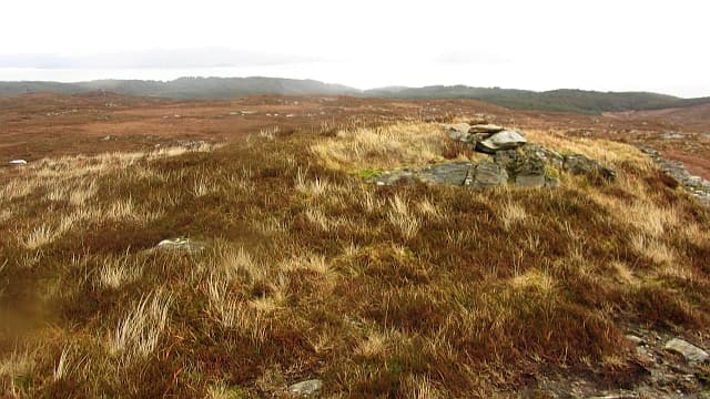
Sgurr nan Caorach (peak of the sheep) sits near the southern tip of the Sleat peninsula at 281m, looking south to Mallaig and Knoydart across the Sound of Sleat. A frequently overlooked little summit at Skye's far end.
Quick facts
- Height
- 281.2m/ 923ft
- Prominence
- 216 m
- Grid ref
- NG 59377 03000
- Dogs
- Dogs on lead required near livestockDog-friendly guide ↗
Height and prominence cross-checked against the Database of British and Irish Hills (CC BY).
No GPX track yet
Walked this route? Share your track to help other walkers.
Standard route
heather moorland 55% · rocky slopes 30% · grass slopes 15%
From the road end at Aird of Sleat, take the Point of Sleat path then break off east to climb the short heathery hillside. Around 6 km return including the walk-in.
Terrain
Good path for the first kilometre then rough heather and sheep-cropped grass to the small rocky top.
In winter
Mild maritime location keeps this snow-free most years. Combine with the lighthouse walk to Point of Sleat for a memorable short winter trip.
Best time of year
Getting there
- Glasgow5h 25m
- Edinburgh8h 44m
OS maps: OS Landranger 32, OS Landranger 39, OS Explorer 412
Mobile signal: Poor. No reliable coverage; remote island or Skye hill with no infrastructure.
Current conditions
Daylight Today
- Sunrise
- 05:18
- Sunset
- 21:43
- Civil dawn
- 04:26
- Civil dusk
- 22:35
NOAA Solar Calculator · 30 July 2026
Around Sgurr nan Caorach on the SCOT network
Getting there, basing yourself, and what to do off the hill.
Sgurr nan Caorach — common questions
- Is Sgurr nan Caorach a hard climb?
- Sgurr nan Caorach is rated 1/5 (easy) on the OutdoorSCOT scale. Underfoot: Good path for the first kilometre then rough heather and sheep-cropped grass to the small rocky top.
- What is Sgurr nan Caorach's prominence?
- 216m of prominence. That's the vertical drop from the summit to the col that links Sgurr nan Caorach to the next higher ground. That drop is what qualifies it as a Marilyn — a hill with at least 150m of descent on every side.
- When is the best time to climb Sgurr nan Caorach?
- March, April, May, June, July, August, September, October give the most reliable conditions on Sgurr nan Caorach. Beyond that window the high ground turns wintry: carry full mountain kit, be confident navigating, and check the SAIS avalanche forecast for the area.
- Is Sgurr nan Caorach dog-friendly?
- Yes, but dogs must be kept on a lead — there is livestock or ground-nesting bird interest on the route.
- Is there mobile signal on Sgurr nan Caorach?
- Poor. No reliable coverage; remote island or Skye hill with no infrastructure.
- Is Sgurr nan Caorach safe in winter?
- Mild maritime location keeps this snow-free most years. Combine with the lighthouse walk to Point of Sleat for a memorable short winter trip.
Get the OutdoorSCOT weekly
One email a week — new route, hill and bothy guides, seasonal conditions and the odd hard-won lesson. No spam, unsubscribe in one click.