Marilyn · Skye
Sgurr na h-Iolaire
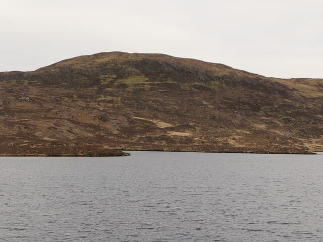
Sgurr na h-Iolaire — peak of the eagle — is a sharp 292m crest above Ord on south Sleat, with a striking little summit cone visible from the road. Sea eagles do still hunt the surrounding shore.
Gaelic: “sharp peak, of the, eagle” · Pronunciation: skoor na h ull-ar-a
Quick facts
- Height
- 292m/ 958ft
- Prominence
- 179 m
- Grid ref
- NG 61716 09051
- Dogs
- Dogs on lead required near livestockDog-friendly guide ↗
Height and prominence cross-checked against the Database of British and Irish Hills (CC BY).
No GPX track yet
Walked this route? Share your track to help other walkers.
Standard route
heather moorland 50% · rocky slopes 35% · grass slopes 15%
Short walk from Ord up the heathery east flank, with a brief easy scramble at the summit cone. About 3 km return and a quick 1-2 hours on the hill.
Terrain
Heather lower down, then short turf and a final rocky crest. The summit rocks form a natural eyrie-like perch overlooking the sea.
In winter
Almost always snow-free. The short scramble at the top would need care if iced but the rest of the walk poses no winter difficulty.
Best time of year
Getting there
- Glasgow5h 26m
- Edinburgh8h 43m
OS maps: OS Landranger 32, OS Explorer 412
Mobile signal: Poor. Remote Inner Hebrides or Skye; limited coverage.
Current conditions
Daylight Today
- Sunrise
- 05:18
- Sunset
- 21:43
- Civil dawn
- 04:25
- Civil dusk
- 22:35
NOAA Solar Calculator · 30 July 2026
Around Sgurr na h-Iolaire on the SCOT network
Getting there, basing yourself, and what to do off the hill.
Getting there: Mallaig station
End of the Road to the Isles — ferry to Skye, Knoydart, Small Isles
13km from the hill
tripscot.co.uk
On TripSCOTBase yourself in Mallaig
Ferry port for Skye and the Small Isles; CWT finish supply
14km from the hill
tripscot.co.uk
On TasteSCOTAfter the hill: Isle of Raasay Distillery
Raasay — new island distillery with rooms; Dun Caan walks from the door
28km from the hill
tastescot.co.uk
Sgurr na h-Iolaire — common questions
- What difficulty is Sgurr na h-Iolaire?
- On the OutdoorSCOT scale, Sgurr na h-Iolaire comes in at 1/5 — easy. Ground conditions: Heather lower down, then short turf and a final rocky crest.
- How much drop does Sgurr na h-Iolaire have?
- The drop is 179m: measured from the summit of Sgurr na h-Iolaire down to the saddle joining it to higher terrain. Passing the 150m-drop threshold on all sides is exactly what makes it a Marilyn.
- What's the best month to climb Sgurr na h-Iolaire?
- Aim for March, April, May, June, July, August, September, October on Sgurr na h-Iolaire. In the remaining months treat it as a winter hill — full kit, solid navigation, and a look at the relevant SAIS avalanche forecast before you go.
- Can dogs go up Sgurr na h-Iolaire?
- Dogs are fine on a lead. The route passes livestock or ground-nesting bird habitat, so keep them close throughout.
- Will I get phone signal on Sgurr na h-Iolaire?
- Poor. Remote Inner Hebrides or Skye; limited coverage.
- Is Sgurr na h-Iolaire safe in winter?
- Almost always snow-free. The short scramble at the top would need care if iced but the rest of the walk poses no winter difficulty.
Get the OutdoorSCOT weekly
One email a week — new route, hill and bothy guides, seasonal conditions and the odd hard-won lesson. No spam, unsubscribe in one click.