Marilyn · Skye
Beinn nan Carn
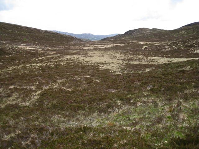
Beinn nan Carn is a 301m gentle summit on the Sleat peninsula of south Skye, set among native birch and oak woodland — a rare habitat for a Scottish Marilyn. The walk feels more lowland forest than Highland hill.
Quick facts
- Height
- 301m/ 988ft
- Prominence
- 248 m
- Grid ref
- NG 63607 18079
- Dogs
- Dogs on lead required near livestockDog-friendly guide ↗
Height and prominence cross-checked against the Database of British and Irish Hills (CC BY).
No GPX track yet
Walked this route? Share your track to help other walkers.
Standard route
heather moorland 55% · rocky slopes 30% · grass slopes 15%
Start from the minor road near Tarskavaig or Ord and climb through woodland onto rough pasture and heather. About 5 km return with steady but never steep gradient.
Terrain
Mossy woodland floor on lower ground, opening to rough pasture with bracken in summer. The summit area is small heathery knolls with occasional cairns.
In winter
Sheltered woodland approach is welcome in wet winter weather. Snow rare at this elevation but the bracken die-back makes winter visibility better.
Best time of year
Getting there
- Glasgow6h 31m
- Edinburgh8h 45m
OS maps: OS Landranger 32, OS Explorer 412
Mobile signal: Poor. Remote Inner Hebrides island; no EE or Vodafone signal.
Current conditions
Daylight Today
- Sunrise
- 05:17
- Sunset
- 21:43
- Civil dawn
- 04:25
- Civil dusk
- 22:36
NOAA Solar Calculator · 30 July 2026
Around Beinn nan Carn on the SCOT network
Getting there, basing yourself, and what to do off the hill.
Getting there: Kyle of Lochalsh station
Skye Bridge; Five Sisters of Kintail; Glen Shiel; Plockton
15km from the hill
tripscot.co.uk
On TripSCOTBase yourself in Mallaig
Ferry port for Skye and the Small Isles; CWT finish supply
22km from the hill
tripscot.co.uk
On TasteSCOTAfter the hill: Isle of Raasay Distillery
Raasay — new island distillery with rooms; Dun Caan walks from the door
21km from the hill
tastescot.co.uk
Beinn nan Carn — common questions
- How hard is Beinn nan Carn?
- We grade Beinn nan Carn at 1/5, which puts it in easy territory. Terrain: Mossy woodland floor on lower ground, opening to rough pasture with bracken in summer.
- How prominent is Beinn nan Carn?
- Beinn nan Carn has 248m of topographic prominence — the height of its summit above the highest col connecting it to higher ground. Marilyns are defined by that measure: at least 150m of drop on all sides.
- When should I climb Beinn nan Carn?
- The standard good-weather months for Beinn nan Carn are March, April, May, June, July, August, September, October. Outside those months, expect winter conditions on the high ground — full mountain kit, navigation skills, and a check of the SAIS avalanche forecast for the relevant region.
- Can I bring my dog up Beinn nan Carn?
- On a lead only — the route crosses ground with livestock or nesting-bird interest.
- What's mobile reception like on Beinn nan Carn?
- Poor. Remote Inner Hebrides island; no EE or Vodafone signal.
- Is Beinn nan Carn safe in winter?
- Sheltered woodland approach is welcome in wet winter weather. Snow rare at this elevation but the bracken die-back makes winter visibility better.
Get the OutdoorSCOT weekly
One email a week — new route, hill and bothy guides, seasonal conditions and the odd hard-won lesson. No spam, unsubscribe in one click.