Marilyn · Orkney & Shetland
Scrae Field
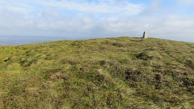
Scrae Field is a broad peat dome in central Shetland Mainland, rising from the moorland that stretches between Voe and the head of Dales Voe. At 216m it has the wide horizon typical of inner Shetland — peat hags in every direction and the silver glint of distant sea lochs.
Quick facts
- Height
- 216m/ 709ft
- Prominence
- 182 m
- Grid ref
- HU 41788 36135
- Dogs
- Dogs on lead required near livestockDog-friendly guide ↗
Height and prominence cross-checked against the Database of British and Irish Hills (CC BY).
No GPX track yet
Walked this route? Share your track to help other walkers.
Standard route
blanket bog 55% · heather moorland 30% · rocky summit 15%
Approach from the A970 near Voe or from the lay-by at Aith Voe, then strike up across open peat to the summit cairn. Distance is short but the going is slow on hag-cut ground; pick a line and commit rather than weaving.
Terrain
Classic Shetland blanket bog — deep peat hags, sphagnum lawns and stretches of bare eroded peat. Cotton-grass and crowberry on the drier ground; expect wet feet whatever the season.
In winter
Mild but very wet underfoot, with the peat saturated for months on end. Frost can briefly stiffen the hags into useful walking surfaces; gales push cloud over the plateau quickly.
Best time of year
Getting there
- Glasgow13h 28m
- Edinburgh12h 52m
Ferry access
Aberdeen → Lerwick (Shetland)
- Crossing time720 min
- Summer sailingsDaily overnight sailing (Apr–Oct)
- Winter sailingsDaily overnight sailing (Nov–Mar)
- Book ahead14 days
A 12-hour overnight sailing — book a cabin berth. Plan a multi-day Shetland trip; the island is large and the journey is substantial. Flights from Aberdeen/Edinburgh are a faster alternative.
Book on ferry operator ↗OS maps: OS Landranger 4, OS Explorer 466N
Mobile signal: Poor. EE absent; closest coverage near Lerwick or Brae.
Current conditions
Daylight Today
- Sunrise
- 04:40
- Sunset
- 21:43
- Civil dawn
- 03:37
- Civil dusk
- 22:46
NOAA Solar Calculator · 30 July 2026
Scrae Field — common questions
- Is Scrae Field a hard climb?
- Scrae Field is rated 1/5 (easy) on the OutdoorSCOT scale. Ground conditions: Classic Shetland blanket bog — deep peat hags, sphagnum lawns and stretches of bare eroded peat.
- How much drop does Scrae Field have?
- The drop is 182m: measured from the summit of Scrae Field down to the saddle joining it to higher terrain. Passing the 150m-drop threshold on all sides is exactly what makes it a Marilyn.
- What's the best month to climb Scrae Field?
- Aim for March, April, May, June, July, August, September, October on Scrae Field. In the remaining months treat it as a winter hill — full kit, solid navigation, and a look at the relevant SAIS avalanche forecast before you go.
- Can dogs go up Scrae Field?
- Dogs are fine on a lead. The route passes livestock or ground-nesting bird habitat, so keep them close throughout.
- Will I get phone signal on Scrae Field?
- Poor. EE absent; closest coverage near Lerwick or Brae.
- How do I get the ferry to Scrae Field?
- Aberdeen → Lerwick (Shetland). Daily overnight sailing (Apr–Oct) in summer; Daily overnight sailing (Nov–Mar) in winter. Book at least 14 days ahead. A 12-hour overnight sailing — book a cabin berth. Plan a multi-day Shetland trip; the island is large and the journey is substantial. Flights from Aberdeen/Edinburgh are a faster alternative.
- Is Scrae Field safe in winter?
- Mild but very wet underfoot, with the peat saturated for months on end. Frost can briefly stiffen the hags into useful walking surfaces; gales push cloud over the plateau quickly.
Get the OutdoorSCOT weekly
One email a week — new route, hill and bothy guides, seasonal conditions and the odd hard-won lesson. No spam, unsubscribe in one click.