Marilyn · Orkney & Shetland
Royl Field
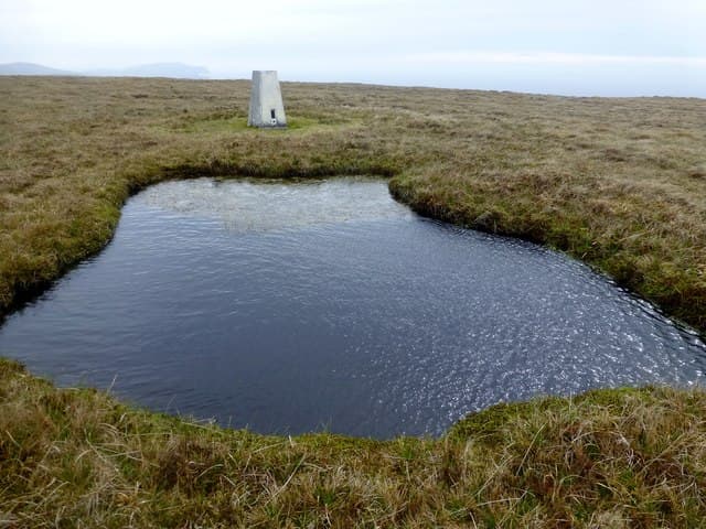
Royl Field reaches 293m on the south Mainland of Shetland, a broad heather summit overlooking the lochs of Tingwall and Sandwick. The hill has the typical Shetland feel — wide, peaty, sparse, with the sea always visible in some direction.
Quick facts
- Height
- 293m/ 961ft
- Prominence
- 287 m
- Grid ref
- HU 39591 28506
- Dogs
- Dogs on lead required near livestockDog-friendly guide ↗
Height and prominence cross-checked against the Database of British and Irish Hills (CC BY).
No GPX track yet
Walked this route? Share your track to help other walkers.
Standard route
blanket bog 55% · heather moorland 30% · rocky summit 15%
Most ascents start from the minor road at Cunningsburgh, climbing west across peat moor onto the rounded summit. Around 6km return with 250m of climb, taking 2-3 hours. No path of any clarity — purely open hill walking.
Terrain
Peat bog and tussock dominate. Drainage is poor in places, with hags and groughs slowing progress. Heather and short grass higher up.
In winter
Snow rarely settles deep but the ground freezes hard, sometimes making the bog easier to cross. Daylight is the main constraint — only six hours in midwinter.
Best time of year
Getting there
- Glasgow13h 15m
- Edinburgh12h 40m
Ferry access
Aberdeen → Lerwick (Shetland)
- Crossing time720 min
- Summer sailingsDaily overnight sailing (Apr–Oct)
- Winter sailingsDaily overnight sailing (Nov–Mar)
- Book ahead14 days
A 12-hour overnight sailing — book a cabin berth. Plan a multi-day Shetland trip; the island is large and the journey is substantial. Flights from Aberdeen/Edinburgh are a faster alternative.
Book on ferry operator ↗OS maps: OS Landranger 4, OS Explorer 466N
Mobile signal: Poor. Remote central Shetland; limited coverage.
Current conditions
Daylight Today
- Sunrise
- 04:40
- Sunset
- 21:43
- Civil dawn
- 03:38
- Civil dusk
- 22:45
NOAA Solar Calculator · 30 July 2026
Royl Field — common questions
- How hard is Royl Field?
- We grade Royl Field at 2/5, which puts it in moderate territory. Terrain: Peat bog and tussock dominate.
- How prominent is Royl Field?
- Royl Field has 287m of topographic prominence — the height of its summit above the highest col connecting it to higher ground. Marilyns are defined by that measure: at least 150m of drop on all sides.
- When should I climb Royl Field?
- The standard good-weather months for Royl Field are March, April, May, June, July, August, September, October. Outside those months, expect winter conditions on the high ground — full mountain kit, navigation skills, and a check of the SAIS avalanche forecast for the relevant region.
- Can I bring my dog up Royl Field?
- On a lead only — the route crosses ground with livestock or nesting-bird interest.
- What's mobile reception like on Royl Field?
- Poor. Remote central Shetland; limited coverage.
- How do I get the ferry to Royl Field?
- Aberdeen → Lerwick (Shetland). Daily overnight sailing (Apr–Oct) in summer; Daily overnight sailing (Nov–Mar) in winter. Book at least 14 days ahead. A 12-hour overnight sailing — book a cabin berth. Plan a multi-day Shetland trip; the island is large and the journey is substantial. Flights from Aberdeen/Edinburgh are a faster alternative.
- Is Royl Field safe in winter?
- Snow rarely settles deep but the ground freezes hard, sometimes making the bog easier to cross. Daylight is the main constraint — only six hours in midwinter.
Get the OutdoorSCOT weekly
One email a week — new route, hill and bothy guides, seasonal conditions and the odd hard-won lesson. No spam, unsubscribe in one click.