Marilyn · Outer Hebrides
Roineabhal
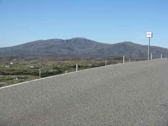
Roineabhal is the bold 460m peak overlooking Rodel at the southern tip of Harris, an isolated anorthosite mountain once proposed as a superquarry. The summit gives wonderful views over the Sound of Harris to the Uists and the distant Cuillin of Skye.
Quick facts
- Height
- 460m/ 1509ft
- Prominence
- 406 m
- Grid ref
- NG 04253 86081
- Dogs
- Dogs on lead required near livestockDog-friendly guide ↗
Height and prominence cross-checked against the Database of British and Irish Hills (CC BY).
No GPX track yet
Walked this route? Share your track to help other walkers.
Standard route
Lewisian gneiss 45% · blanket bog 35% · rocky summit 20%
From the road end at Lingerabay or near Rodel, climb the northern shoulder over heather and bare rock. About four hours return with steady gradient and a fine summit ridge.
Terrain
Heather and bog low down quickly give way to pale anorthosite slabs and scree higher up. The summit ridge is rocky with a small cairn.
In winter
Snow rarely deep but the slabs become slippery when frozen. Wind on the south Harris coast is unrelenting in winter and there is no shelter on the upper hill.
Best time of year
Getting there
- Glasgow9h 36m
- Edinburgh11h 52m
Ferry access
Uig (Skye) → Tarbert (Harris)
- Crossing time105 min
- Summer sailings2 sailings daily (Apr–Oct)
- Winter sailings1 sailing daily (Nov–Mar)
- Book ahead14 days
- Last ferry backCheck CalMac timetable — last sailing to Uig varies seasonally
Drive to Uig on Skye (Skye Bridge from Kyle of Lochalsh), then ferry to Harris. Alternative: Ullapool → Stornoway (Lewis, 2h45) and drive south.
Book on CalMac ↗OS maps: OS Landranger 18, OS Explorer 455
Mobile signal: Poor. Remote South Harris; limited coverage.
Current conditions
Daylight Today
- Sunrise
- 05:18
- Sunset
- 21:51
- Civil dawn
- 04:24
- Civil dusk
- 22:45
NOAA Solar Calculator · 30 July 2026
Around Roineabhal on the SCOT network
Getting there, basing yourself, and what to do off the hill.
Roineabhal — common questions
- How hard is Roineabhal?
- We grade Roineabhal at 2/5, which puts it in moderate territory. Underfoot: Heather and bog low down quickly give way to pale anorthosite slabs and scree higher up.
- What is Roineabhal's prominence?
- 406m of prominence. That's the vertical drop from the summit to the col that links Roineabhal to the next higher ground. That drop is what qualifies it as a Marilyn — a hill with at least 150m of descent on every side.
- When is the best time to climb Roineabhal?
- April, May, June, July, August, September, October give the most reliable conditions on Roineabhal. Beyond that window the high ground turns wintry: carry full mountain kit, be confident navigating, and check the SAIS avalanche forecast for the area.
- Is Roineabhal dog-friendly?
- Yes, but dogs must be kept on a lead — there is livestock or ground-nesting bird interest on the route.
- Is there mobile signal on Roineabhal?
- Poor. Remote South Harris; limited coverage.
- How do I get the ferry to Roineabhal?
- Uig (Skye) → Tarbert (Harris). 2 sailings daily (Apr–Oct) in summer; 1 sailing daily (Nov–Mar) in winter. Book at least 14 days ahead. Drive to Uig on Skye (Skye Bridge from Kyle of Lochalsh), then ferry to Harris. Alternative: Ullapool → Stornoway (Lewis, 2h45) and drive south.
- Is Roineabhal safe in winter?
- Snow rarely deep but the slabs become slippery when frozen. Wind on the south Harris coast is unrelenting in winter and there is no shelter on the upper hill.
Get the OutdoorSCOT weekly
One email a week — new route, hill and bothy guides, seasonal conditions and the odd hard-won lesson. No spam, unsubscribe in one click.