Marilyn · Glen Coe & Lochaber
Na Maoilean
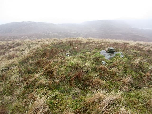
Na Maoilean — the bald places — is a 352m Marilyn in NM-square Argyll, rising from the wooded ground above the Bonawe iron furnace and the south side of Loch Etive near Taynuilt. The summit is a treeless brow of stripped rock looking west to Lismore and Mull and east to the gates of Glen Etive.
Quick facts
- Height
- 352.6m/ 1157ft
- Prominence
- 193 m
- Grid ref
- NM 97534 37208
- Nearest city
- Oban· 14km
- Dogs
- Dogs on lead required near livestockDog-friendly guide ↗
Height and prominence cross-checked against the Database of British and Irish Hills (CC BY).
No GPX track yet
Walked this route? Share your track to help other walkers.
Standard route
heather moorland 55% · coastal grass 30% · rocky summit 15%
A short hill from the B845 above Taynuilt: most walkers leave the road near Airdeny and climb through oak and hazel before emerging onto the bare rocky crest. The final 100m is a wander over slabs and short grass to a small cairn directly above Loch Etive.
Terrain
Atlantic oakwood and hazel below the open hill, with slabby Dalradian schist on top. The rock is grippy when dry but exceptionally slippery when wet — those are the bald places of the name.
In winter
Snow accumulation is minimal at this altitude, and the hazard is rain-frozen lichen on the summit slabs. A pair of stiff soles and a single walking pole handle anything the hill is likely to throw at you between November and March.
This hill is in the Glen Coe SAIS forecast area. Check SAIS forecasts in winter (December–April).
Best time of year
Getting there
- Glasgow3h 8m
- Edinburgh6h 36m
OS maps: OS Landranger 49, OS Explorer 376
Mobile signal: Poor. Remote Argyll coast; coverage here is marginal.
Current conditions
Daylight Today
- Sunrise
- 05:18
- Sunset
- 21:37
- Civil dawn
- 04:28
- Civil dusk
- 22:27
NOAA Solar Calculator · 30 July 2026
Around Na Maoilean on the SCOT network
Getting there, basing yourself, and what to do off the hill.
Na Maoilean — common questions
- What difficulty is Na Maoilean?
- On the OutdoorSCOT scale, Na Maoilean comes in at 1/5 — easy. Underfoot: Atlantic oakwood and hazel below the open hill, with slabby Dalradian schist on top.
- What is Na Maoilean's prominence?
- 193m of prominence. That's the vertical drop from the summit to the col that links Na Maoilean to the next higher ground. That drop is what qualifies it as a Marilyn — a hill with at least 150m of descent on every side.
- When is the best time to climb Na Maoilean?
- March, April, May, June, July, August, September, October give the most reliable conditions on Na Maoilean. Beyond that window the high ground turns wintry: carry full mountain kit, be confident navigating, and check the SAIS avalanche forecast for the area.
- Is Na Maoilean dog-friendly?
- Yes, but dogs must be kept on a lead — there is livestock or ground-nesting bird interest on the route.
- Is there mobile signal on Na Maoilean?
- Poor. Remote Argyll coast; coverage here is marginal.
- Is Na Maoilean safe in winter?
- Snow accumulation is minimal at this altitude, and the hazard is rain-frozen lichen on the summit slabs. A pair of stiff soles and a single walking pole handle anything the hill is likely to throw at you between November and March.
Get the OutdoorSCOT weekly
One email a week — new route, hill and bothy guides, seasonal conditions and the odd hard-won lesson. No spam, unsubscribe in one click.