Marilyn · Glen Coe & Lochaber
Beinn Duirinnis
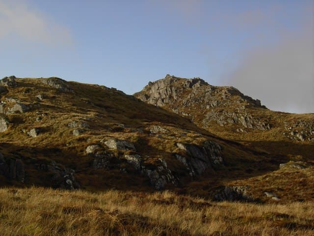
Beinn Duirinnis is the 556m hill above Loch Etive between Inverawe and Taynuilt at NN 021 347. The name probably means "deer-ness peak". The summit stands above the famous Falls of Cruachan on the loch's southern shore, with a long open ridge that drops east to Inverliever Forest and west to the Loch Awe basin.
Quick facts
- Height
- 556m/ 1824ft
- Prominence
- 250 m
- Grid ref
- NN 02105 34757
- Nearest city
- Oban· 17km
- Dogs
- Dogs on lead required near livestockDog-friendly guide ↗
Height and prominence cross-checked against the Database of British and Irish Hills (CC BY).
No GPX track yet
Walked this route? Share your track to help other walkers.
Standard route
heather and bog 65% · grass slopes 25% · rocky summit 10%
Park at the Falls of Cruachan railway halt or at one of the lay-bys on the B845. Climb directly through the steep Atlantic oakwood on the south slopes, then break onto open hill and follow the broad south-east ridge to the summit cairn.
Terrain
Steep oakwood with mossy boulders and bracken on the lower hill, opening to wet grass and heather above. The ridge has occasional craglets that are easily turned. Boggy underfoot in any season.
In winter
Atlantic snow and verglas in the oakwoods; the open ridge gathers patchy drifts. Visibility on the broad summit can drop fast in westerlies. Microspikes are useful on the steep wet rocks at the foot of the climb.
This hill is in the Glen Coe SAIS forecast area. Check SAIS forecasts in winter (December–April).
Best time of year
Getting there
- Glasgow3h 56m
- Edinburgh5h 24m
OS maps: OS Landranger 50, OS Explorer 377W
Mobile signal: Poor. No coverage on this isolated summit; emergency plans essential.
Current conditions
Daylight Today
- Sunrise
- 05:18
- Sunset
- 21:36
- Civil dawn
- 04:28
- Civil dusk
- 22:27
NOAA Solar Calculator · 30 July 2026
Around Beinn Duirinnis on the SCOT network
Getting there, basing yourself, and what to do off the hill.
Beinn Duirinnis — common questions
- What difficulty is Beinn Duirinnis?
- On the OutdoorSCOT scale, Beinn Duirinnis comes in at 2/5 — moderate. Underfoot: Steep oakwood with mossy boulders and bracken on the lower hill, opening to wet grass and heather above.
- What is Beinn Duirinnis's prominence?
- 250m of prominence. That's the vertical drop from the summit to the col that links Beinn Duirinnis to the next higher ground. That drop is what qualifies it as a Marilyn — a hill with at least 150m of descent on every side.
- When is the best time to climb Beinn Duirinnis?
- March, April, May, June, July, August, September, October give the most reliable conditions on Beinn Duirinnis. Beyond that window the high ground turns wintry: carry full mountain kit, be confident navigating, and check the SAIS avalanche forecast for the area.
- Is Beinn Duirinnis dog-friendly?
- Yes, but dogs must be kept on a lead — there is livestock or ground-nesting bird interest on the route.
- Is there mobile signal on Beinn Duirinnis?
- Poor. No coverage on this isolated summit; emergency plans essential.
- Is Beinn Duirinnis safe in winter?
- Atlantic snow and verglas in the oakwoods; the open ridge gathers patchy drifts. Visibility on the broad summit can drop fast in westerlies. Microspikes are useful on the steep wet rocks at the foot of the climb.
Get the OutdoorSCOT weekly
One email a week — new route, hill and bothy guides, seasonal conditions and the odd hard-won lesson. No spam, unsubscribe in one click.