Marilyn · Skye & The Small Isles
Mullach Mor
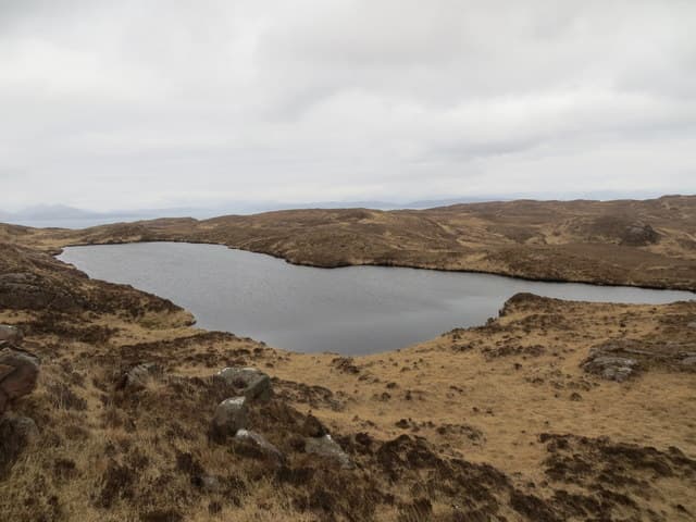
Mullach Mor — the Big Summit — is the high point of the Small Isle of Canna, rising 304m above cliff-bound basalt pastures. The view from the top spans Rum's Cuillin, the Skye ridge and the open Sea of the Hebrides, a reward wildly out of proportion to the modest height.
Gaelic: “summit, big” · Pronunciation: mull-ach more
Quick facts
- Height
- 304m/ 997ft
- Prominence
- 219 m
- Grid ref
- NG 38668 01502
- Dogs
- Dogs on lead required near livestockDog-friendly guide ↗
Height and prominence cross-checked against the Database of British and Irish Hills (CC BY).
No GPX track yet
Walked this route? Share your track to help other walkers.
Standard route
heather moorland 55% · rocky slopes 30% · grass slopes 15%
From the harbour at Canna Pier follow the island track east past Canna House, then strike north-east across grazed pasture toward the summit cairn. The going is gentle but unmarked, with sheep tracks providing intermittent help on the final rise. Total time on foot is around 2 to 3 hours from the pier.
Terrain
Open basalt pasture grazed by sheep and Highland cattle, with patches of damp tussock between drier ridges. There are no continuous paths — navigation is line-of-sight in clear weather.
In winter
Snow seldom lies on Canna but the island sits exposed to the full Atlantic. Winter visits depend on the CalMac ferry from Mallaig, which can be cancelled at short notice during gales.
Best time of year
Getting there
- Glasgow6h 8m
- Edinburgh9h 32m
Ferry access
Mallaig → Canna (via Rum and Eigg)
- Crossing time195 min
- Summer sailings2–3 sailings per week (Apr–Oct)
- Winter sailings1–2 sailings per week (Nov–Mar)
- Book ahead21 days
One of Scotland's most remote ferry destinations — over 3 hours each way. Overnight stay essential. Very limited supplies on the island; bring all food.
Book on CalMac ↗OS maps: OS Landranger 32, OS Landranger 39, OS Explorer 397
Mobile signal: Poor. Remote island location; limited coverage.
Current conditions
Daylight Today
- Sunrise
- 05:19
- Sunset
- 21:44
- Civil dawn
- 04:28
- Civil dusk
- 22:36
NOAA Solar Calculator · 30 July 2026
Around Mullach Mor on the SCOT network
Getting there, basing yourself, and what to do off the hill.
Mullach Mor — common questions
- Is Mullach Mor a hard climb?
- Mullach Mor is rated 1/5 (easy) on the OutdoorSCOT scale. Underfoot: Open basalt pasture grazed by sheep and Highland cattle, with patches of damp tussock between drier ridges.
- What is Mullach Mor's prominence?
- 219m of prominence. That's the vertical drop from the summit to the col that links Mullach Mor to the next higher ground. That drop is what qualifies it as a Marilyn — a hill with at least 150m of descent on every side.
- When is the best time to climb Mullach Mor?
- March, April, May, June, July, August, September, October give the most reliable conditions on Mullach Mor. Beyond that window the high ground turns wintry: carry full mountain kit, be confident navigating, and check the SAIS avalanche forecast for the area.
- Is Mullach Mor dog-friendly?
- Yes, but dogs must be kept on a lead — there is livestock or ground-nesting bird interest on the route.
- Is there mobile signal on Mullach Mor?
- Poor. Remote island location; limited coverage.
- How do I get the ferry to Mullach Mor?
- Mallaig → Canna (via Rum and Eigg). 2–3 sailings per week (Apr–Oct) in summer; 1–2 sailings per week (Nov–Mar) in winter. Book at least 21 days ahead. One of Scotland's most remote ferry destinations — over 3 hours each way. Overnight stay essential. Very limited supplies on the island; bring all food.
- Is Mullach Mor safe in winter?
- Snow seldom lies on Canna but the island sits exposed to the full Atlantic. Winter visits depend on the CalMac ferry from Mallaig, which can be cancelled at short notice during gales.
Get the OutdoorSCOT weekly
One email a week — new route, hill and bothy guides, seasonal conditions and the odd hard-won lesson. No spam, unsubscribe in one click.