Marilyn · Outer Hebrides
Mullach Buidhe
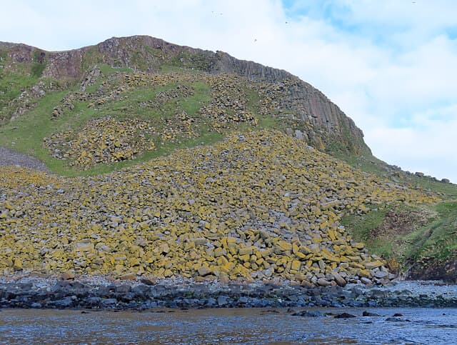
Mullach Buidhe, the yellow summit, is the high point of Scalpay, the small island off east Harris linked by bridge from Tarbert. At 161m it is one of the lowest Marilyns yet rewards visitors with intimate views of the Minch and Eilean Glas lighthouse.
Gaelic: “summit, yellow” · Pronunciation: mull-ach boo-yeh
Quick facts
- Height
- 161.8m/ 531ft
- Prominence
- 162 m
- Grid ref
- NG 41485 98645
- Dogs
- Dogs on lead required near livestockDog-friendly guide ↗
Height and prominence cross-checked against the Database of British and Irish Hills (CC BY).
No GPX track yet
Walked this route? Share your track to help other walkers.
Standard route
Lewisian gneiss 45% · blanket bog 35% · rocky summit 20%
Cross the Scalpay bridge and park near the school, then follow the waymarked lighthouse path before peeling off north to the summit. A pleasant two-hour outing combining moorland, paths and rocky knolls.
Terrain
Mix of waymarked path, short heather and gneiss slabs. The summit dome has bare yellow-lichened rock that gives the hill its name.
In winter
Mild but exposed to Minch storms; snow is rare. The lighthouse path is usable year round but the boggy summit ground turns greasy after rain.
Best time of year
Getting there
- Glasgow8h 36m
- Edinburgh10h 39m
OS maps: OS Landranger 14, OS Explorer 457
Mobile signal: Poor. No reliable coverage; nearest EE signal near Tarbert.
Current conditions
Daylight Today
- Sunrise
- 06:53
- Sunset
- 19:50
- Civil dawn
- 06:13
- Civil dusk
- 20:30
NOAA Solar Calculator · 14 September 2026
Around Mullach Buidhe on the SCOT network
Getting there, basing yourself, and what to do off the hill.
Mullach Buidhe — common questions
- What difficulty is Mullach Buidhe?
- On the OutdoorSCOT scale, Mullach Buidhe comes in at 1/5 — easy. Underfoot: Mix of waymarked path, short heather and gneiss slabs.
- What is Mullach Buidhe's prominence?
- Mullach Buidhe's prominence is its full height — 162m — because it is the highest point of its landmass, with no higher ground connected to it. That drop is what qualifies it as a Marilyn — a hill with at least 150m of descent on every side.
- When is the best time to climb Mullach Buidhe?
- March, April, May, June, July, August, September, October give the most reliable conditions on Mullach Buidhe. Beyond that window the high ground turns wintry: carry full mountain kit, be confident navigating, and check the SAIS avalanche forecast for the area.
- Is Mullach Buidhe dog-friendly?
- Yes, but dogs must be kept on a lead — there is livestock or ground-nesting bird interest on the route.
- Is there mobile signal on Mullach Buidhe?
- Poor. No reliable coverage; nearest EE signal near Tarbert.
- Is Mullach Buidhe safe in winter?
- Mild but exposed to Minch storms; snow is rare. The lighthouse path is usable year round but the boggy summit ground turns greasy after rain.
Get the OutdoorSCOT weekly
One email a week — new route, hill and bothy guides, seasonal conditions and the odd hard-won lesson. No spam, unsubscribe in one click.