Marilyn · Outer Hebrides
Gormol
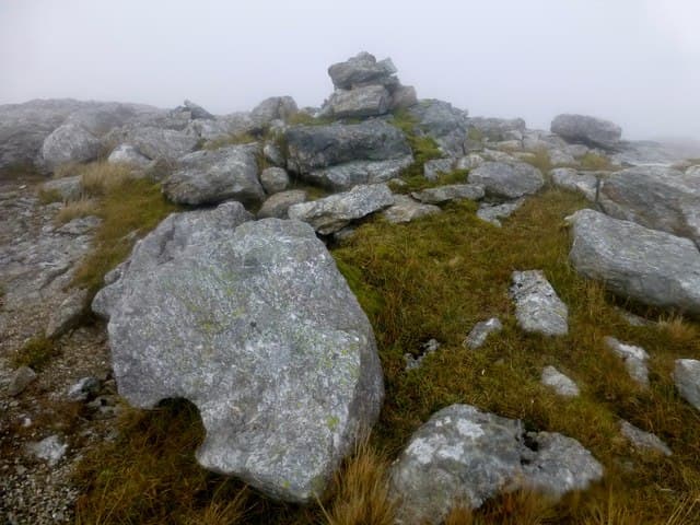
Gormol rises to 470m above the Eishken estate on the eastern flank of the Pairc peninsula, a rugged gneiss prow overlooking Loch Sealg and the open Minch. Its position close to the road makes it one of the more accessible Pairc Marilyns.
Quick facts
- Height
- 470m/ 1542ft
- Prominence
- 322 m
- Grid ref
- NB 30188 06910
- Dogs
- Dogs on lead required near livestockDog-friendly guide ↗
Height and prominence cross-checked against the Database of British and Irish Hills (CC BY).
No GPX track yet
Walked this route? Share your track to help other walkers.
Standard route
blanket bog 50% · Lewisian gneiss 35% · heather moorland 15%
A 12-14km round from the end of the public road at Eishken, following the Allt na Cailliche and then climbing the open hillside to a small cairn. Allow 5-6 hours; tracks help on the lower section.
Terrain
Estate tracks for the first kilometres give way to typical Pairc gneiss and peat. The upper slope steepens into a stepped outcrop band. Active stalking estate — phone ahead in season.
In winter
Lower altitude means snow is unusual, but the long approach across saturated peat is harder and slower in winter. Headtorches are essential after late afternoon.
Best time of year
Getting there
- Glasgow8h 6m
- Edinburgh10h 11m
Ferry access
Uig (Skye) → Tarbert (Harris)
- Crossing time105 min
- Summer sailings2 sailings daily (Apr–Oct)
- Winter sailings1 sailing daily (Nov–Mar)
- Book ahead14 days
- Last ferry backCheck CalMac timetable — last sailing to Uig varies seasonally
Drive to Uig on Skye (Skye Bridge from Kyle of Lochalsh), then ferry to Harris. Alternative: Ullapool → Stornoway (Lewis, 2h45) and drive south.
Book on CalMac ↗OS maps: OS Landranger 13, OS Landranger 14, OS Explorer 457
Mobile signal: Poor. EE and Vodafone give nothing; Lewis trackless terrain has no signal.
Current conditions
Daylight Today
- Sunrise
- 05:15
- Sunset
- 21:50
- Civil dawn
- 04:20
- Civil dusk
- 22:45
NOAA Solar Calculator · 30 July 2026
Around Gormol on the SCOT network
Getting there, basing yourself, and what to do off the hill.
Gormol — common questions
- How difficult is Gormol?
- Gormol carries a 2/5 (moderate) grade on the OutdoorSCOT scale. Underfoot: Estate tracks for the first kilometres give way to typical Pairc gneiss and peat.
- What is Gormol's prominence?
- 322m of prominence. That's the vertical drop from the summit to the col that links Gormol to the next higher ground. That drop is what qualifies it as a Marilyn — a hill with at least 150m of descent on every side.
- When is the best time to climb Gormol?
- April, May, June, July, August give the most reliable conditions on Gormol. Beyond that window the high ground turns wintry: carry full mountain kit, be confident navigating, and check the SAIS avalanche forecast for the area.
- Is Gormol dog-friendly?
- Yes, but dogs must be kept on a lead — there is livestock or ground-nesting bird interest on the route.
- Is there mobile signal on Gormol?
- Poor. EE and Vodafone give nothing; Lewis trackless terrain has no signal.
- How do I get the ferry to Gormol?
- Uig (Skye) → Tarbert (Harris). 2 sailings daily (Apr–Oct) in summer; 1 sailing daily (Nov–Mar) in winter. Book at least 14 days ahead. Drive to Uig on Skye (Skye Bridge from Kyle of Lochalsh), then ferry to Harris. Alternative: Ullapool → Stornoway (Lewis, 2h45) and drive south.
- Is Gormol safe in winter?
- Lower altitude means snow is unusual, but the long approach across saturated peat is harder and slower in winter. Headtorches are essential after late afternoon.
Get the OutdoorSCOT weekly
One email a week — new route, hill and bothy guides, seasonal conditions and the odd hard-won lesson. No spam, unsubscribe in one click.