Marilyn · Outer Hebrides
Beinn Mhor
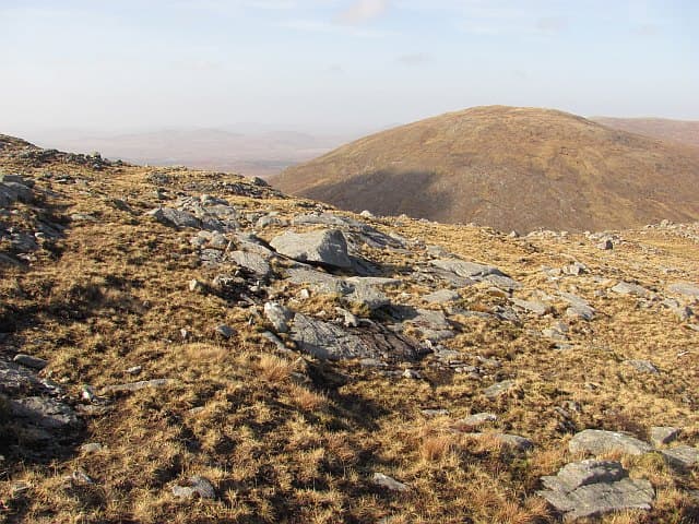
Beinn Mhor — simply the Big Hill in Gaelic — is the dominant summit of the Pairc peninsula in south Lewis, rising to 572m above the deer-haunted glens of the Park forest. It is one of the most isolated Marilyns in Britain, ringed by trackless gneiss country and sea lochs on three sides.
Gaelic: “mountain, big” · Pronunciation: bine vore
Quick facts
- Height
- 572m/ 1877ft
- Grid ref
- NB 25439 09529
- Dogs
- Dogs on lead required near livestockDog-friendly guide ↗
No GPX track yet
Walked this route? Share your track to help other walkers.
Standard route
Lewisian gneiss 45% · blanket bog 35% · rough grassland 20%
Long walk-ins of 20km or more are typical, usually from Cleitir on the south or from the lonely B8060 north of Eishken. Expect 8-10 hours on the round, with the final ascent up steep grass and boulders to a small summit cairn.
Terrain
Ancient Lewisian gneiss outcrops, peat hags, deer-cropped grass and boulder fields. There are no paths or tracks across the main approach country. Stalking activity occurs in autumn — check before visiting.
In winter
Remote even in summer, the Pairc becomes seriously committing in winter. Snow can lie on the upper slabs and the long return after dark in poor weather is hazardous; treat as a full expedition.
Best time of year
Getting there
- Glasgow8h 18m
- Edinburgh10h 23m
Ferry access
Uig (Skye) → Tarbert (Harris)
- Crossing time105 min
- Summer sailings2 sailings daily (Apr–Oct)
- Winter sailings1 sailing daily (Nov–Mar)
- Book ahead14 days
- Last ferry backCheck CalMac timetable — last sailing to Uig varies seasonally
Drive to Uig on Skye (Skye Bridge from Kyle of Lochalsh), then ferry to Harris. Alternative: Ullapool → Stornoway (Lewis, 2h45) and drive south.
Book on CalMac ↗OS maps: OS Landranger 13, OS Landranger 14, OS Explorer 457
Mobile signal: Poor. Remote Lewis/Harris; limited coverage.
Current conditions
Daylight Today
- Sunrise
- 04:25
- Sunset
- 22:34
- Civil dawn
- 03:10
- Civil dusk
- 23:49
NOAA Solar Calculator · 27 June 2026
Around Beinn Mhor on the SCOT network
Getting there, basing yourself, and what to do off the hill.
Beinn Mhor — common questions
- How hard is Beinn Mhor?
- Beinn Mhor is rated 3/5 (moderately challenging) on the OutdoorSCOT scale. Terrain: Ancient Lewisian gneiss outcrops, peat hags, deer-cropped grass and boulder fields.
- When is the best time to climb Beinn Mhor?
- The standard good-weather months for Beinn Mhor are March, April, May, June, July, August, September, October. Outside those months, expect winter conditions on the high ground — full mountain kit, navigation skills, and a check of the SAIS avalanche forecast for the relevant region.
- Can I bring my dog up Beinn Mhor?
- Yes, but dogs must be kept on a lead — there is livestock or ground-nesting bird interest on the route.
- Is there mobile signal on Beinn Mhor?
- Poor. Remote Lewis/Harris; limited coverage.
- How do I get the ferry to Beinn Mhor?
- Uig (Skye) → Tarbert (Harris). 2 sailings daily (Apr–Oct) in summer; 1 sailing daily (Nov–Mar) in winter. Book at least 14 days ahead. Drive to Uig on Skye (Skye Bridge from Kyle of Lochalsh), then ferry to Harris. Alternative: Ullapool → Stornoway (Lewis, 2h45) and drive south.
- Is Beinn Mhor safe in winter?
- Remote even in summer, the Pairc becomes seriously committing in winter. Snow can lie on the upper slabs and the long return after dark in poor weather is hazardous; treat as a full expedition.
Get the OutdoorSCOT weekly
One email a week — new route, hill and bothy guides, seasonal conditions and the odd hard-won lesson. No spam, unsubscribe in one click.