Marilyn · North-West Highlands
Mount Eagle
Mount Eagle — anglicised from the original Gaelic Cnoc na h-Iolaire — rises to 256m at NH 648 590 on the Black Isle, the highest point on the peninsula. The summit is crowned by a Bronze Age cairn and gives panoramic views over the Beauly, Moray and Cromarty Firths from a single spot.
Quick facts
- Height
- 256m/ 840ft
- Prominence
- 221 m
- Grid ref
- NH 64856 59001
- Nearest city
- Inverness· 14km
- Dogs
- Dogs on lead required near livestockDog-friendly guide ↗
Height and prominence cross-checked against the Database of British and Irish Hills (CC BY).
No GPX track yet
Walked this route? Share your track to help other walkers.
Standard route
heather moorland 60% · grass slopes 30% · rocky summit 10%
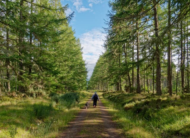
From the B9160 a forestry road climbs through Scots pine to within 300m of the summit. The final approach crosses a clearing to the cairn. About 1.5 hours round trip from the car park at Killen.
Terrain
Old Red Sandstone with a thick mantle of glacial till. The lower slopes are mature pine plantation; the summit is an open clearing of heather and short grass crowned by the prominent Bronze Age cairn.
In winter
Coastal influence keeps the hill nearly snow-free even in cold winters. A reliable year-round walk; the only winter concern is ice on the forestry road, which is shaded by the pines.
This hill is in the Torridon SAIS forecast area. Check SAIS forecasts in winter (December–April).
Best time of year
Getting there
- Glasgow5h 30m
- Edinburgh5h 5m
OS maps: OS Landranger 26, OS Explorer 432
Mobile signal: Reliable up top; EE behaves well. Fine Easter Ross views to the Dornoch Firth.
Current conditions
Daylight Today
- Sunrise
- 05:08
- Sunset
- 21:39
- Civil dawn
- 04:14
- Civil dusk
- 22:33
NOAA Solar Calculator · 30 July 2026
Around Mount Eagle on the SCOT network
Getting there, basing yourself, and what to do off the hill.
Getting there: Dingwall station
Ben Wyvis approach; Easter Ross; junction for Kyle and Far North lines
9km from the hill
tripscot.co.uk
On TripSCOTBase yourself in Inverness
Highland capital — gateway to Cairngorms, Affric, Far North
14km from the hill
tripscot.co.uk
On TasteSCOTAfter the hill: The Dalmore
Alness — sherried Highland flagship; stately Cromarty Firth setting
10km from the hill
tastescot.co.uk
Mount Eagle — common questions
- How difficult is Mount Eagle?
- Mount Eagle carries a 1/5 (easy) grade on the OutdoorSCOT scale. Terrain: Old Red Sandstone with a thick mantle of glacial till.
- How prominent is Mount Eagle?
- Mount Eagle has 221m of topographic prominence — the height of its summit above the highest col connecting it to higher ground. Marilyns are defined by that measure: at least 150m of drop on all sides.
- When should I climb Mount Eagle?
- The standard good-weather months for Mount Eagle are March, April, May, June, July, August, September, October. Outside those months, expect winter conditions on the high ground — full mountain kit, navigation skills, and a check of the SAIS avalanche forecast for the relevant region.
- Can I bring my dog up Mount Eagle?
- On a lead only — the route crosses ground with livestock or nesting-bird interest.
- What's mobile reception like on Mount Eagle?
- Reliable up top; EE behaves well. Fine Easter Ross views to the Dornoch Firth.
- Is Mount Eagle safe in winter?
- Coastal influence keeps the hill nearly snow-free even in cold winters. A reliable year-round walk; the only winter concern is ice on the forestry road, which is shaded by the pines.
Get the OutdoorSCOT weekly
One email a week — new route, hill and bothy guides, seasonal conditions and the odd hard-won lesson. No spam, unsubscribe in one click.