Marilyn · North-West Highlands
Cnoc an t-Sabhail
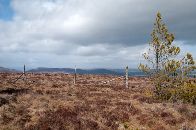
This first Cnoc an t-Sabhail — knoll of the barn — stands 380m at NH 694 786 on the high ground above Edderton. The name is common in northern Scotland and reflects a flat-topped profile resembling a hay barn. It is the higher of two Sutherland hills sharing this name.
Quick facts
- Height
- 380m/ 1247ft
- Prominence
- 209 m
- Grid ref
- NH 69440 78694
- Nearest city
- Inverness· 34km
- Dogs
- Dogs on lead required near livestockDog-friendly guide ↗
Height and prominence cross-checked against the Database of British and Irish Hills (CC BY).
No GPX track yet
Walked this route? Share your track to help other walkers.
Standard route
heather and bog 65% · grass slopes 25% · rocky summit 10%
Best approached from the B9176 (the Struie road) at the Aultnamain Inn, walking 2km north onto open heather. There are no paths but the gradient is gentle throughout. A 3-hour outing.
Terrain
Moine schist with deep peat on the lower slopes. The summit dome is firmer ground of cropped heather and tussock grass; the flat top really does suggest a barn roof from certain angles.
In winter
Modest altitude and an east-coast location keep snow cover transient. A useful winter half-day combined with the second Cnoc an t-Sabhail to the north; both are easy when the high hills are storm-bound.
This hill is in the Torridon SAIS forecast area. Check SAIS forecasts in winter (December–April).
Best time of year
Getting there
- Glasgow5h 58m
- Edinburgh5h 24m
OS maps: OS Landranger 21, OS Explorer 438W
Mobile signal: Very poor. Satellite phone or PLB essential on this remote hill.
Current conditions
Daylight Today
- Sunrise
- 05:07
- Sunset
- 21:40
- Civil dawn
- 04:13
- Civil dusk
- 22:34
NOAA Solar Calculator · 30 July 2026
Around Cnoc an t-Sabhail on the SCOT network
Getting there, basing yourself, and what to do off the hill.
Getting there: Tain station
Easter Ross — Ben Wyvis approach, Glenmorangie distillery
9km from the hill
tripscot.co.uk
On TripSCOTBase yourself in Inverness
Highland capital — gateway to Cairngorms, Affric, Far North
34km from the hill
tripscot.co.uk
On TasteSCOTAfter the hill: Balblair
Edderton — Easter Ross distillery with vintage-led range
8km from the hill
tastescot.co.uk
Cnoc an t-Sabhail — common questions
- Is Cnoc an t-Sabhail a hard climb?
- Cnoc an t-Sabhail is rated 1/5 (easy) on the OutdoorSCOT scale. Underfoot: Moine schist with deep peat on the lower slopes.
- What is Cnoc an t-Sabhail's prominence?
- 209m of prominence. That's the vertical drop from the summit to the col that links Cnoc an t-Sabhail to the next higher ground. That drop is what qualifies it as a Marilyn — a hill with at least 150m of descent on every side.
- When is the best time to climb Cnoc an t-Sabhail?
- March, April, May, June, July, August, September, October give the most reliable conditions on Cnoc an t-Sabhail. Beyond that window the high ground turns wintry: carry full mountain kit, be confident navigating, and check the SAIS avalanche forecast for the area.
- Is Cnoc an t-Sabhail dog-friendly?
- Yes, but dogs must be kept on a lead — there is livestock or ground-nesting bird interest on the route.
- Is there mobile signal on Cnoc an t-Sabhail?
- Very poor. Satellite phone or PLB essential on this remote hill.
- Is Cnoc an t-Sabhail safe in winter?
- Modest altitude and an east-coast location keep snow cover transient. A useful winter half-day combined with the second Cnoc an t-Sabhail to the north; both are easy when the high hills are storm-bound.
Get the OutdoorSCOT weekly
One email a week — new route, hill and bothy guides, seasonal conditions and the odd hard-won lesson. No spam, unsubscribe in one click.