Marilyn · Ochils
Meikle Bin
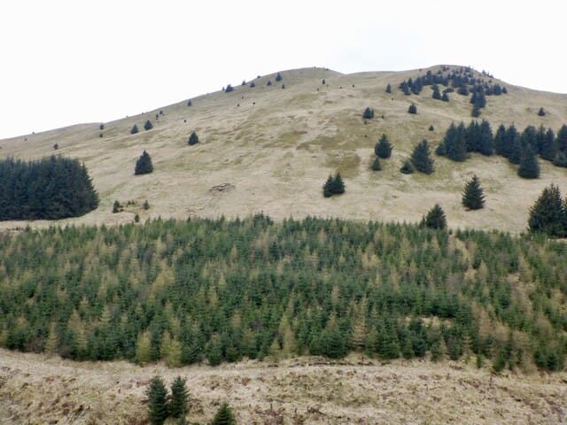
Meikle Bin is the cone-shaped second summit of the Campsie Fells, rising in the NS 667 grid square above the Carron Valley reservoir. Its distinctive profile is recognisable from much of central Scotland and the 570m top gives one of the finest viewpoints in the southern Highlands.
Quick facts
- Height
- 570m/ 1870ft
- Prominence
- 236 m
- Grid ref
- NS 66722 82171
- Nearest city
- Stirling· 17km
- Dogs
- Dogs on lead required near livestockDog-friendly guide ↗
Height and prominence cross-checked against the Database of British and Irish Hills (CC BY).
No GPX track yet
Walked this route? Share your track to help other walkers.
Standard route
volcanic basalt 50% · heather moorland 35% · grass slopes 15%
The shortest line climbs from the Carron Valley forest car park on a Forestry track and then steeply up the heathery cone to the trig. A 9km round on good ground with around 350m of ascent, easily fitted into half a day.
Terrain
Forest road approach gives way to deep heather and peat on the upper cone, with the path eroded to bare basalt in places. Drier underfoot than Earl's Seat thanks to the steeper gradient.
In winter
Hard frost in clear winter weather makes for excellent quick walking and the views to the snow-covered Trossachs are first class. Sheet ice can form on the upper basalt sections after a thaw-freeze cycle.
Best time of year
Getting there
- Glasgow0h 29m
- Edinburgh2h 27m
OS maps: OS Landranger 57, OS Landranger 64, OS Explorer 348
Mobile signal: Good. Central belt; EE reliable.
Current conditions
Daylight Today
- Sunrise
- 06:46
- Sunset
- 19:39
- Civil dawn
- 06:08
- Civil dusk
- 20:17
NOAA Solar Calculator · 14 September 2026
Pair with
Curated multi-hill combinations from Meikle Bin.
Around Meikle Bin on the SCOT network
Getting there, basing yourself, and what to do off the hill.
Getting there: Stirling station
Ochils, Dumyat, Stirling Castle, Wallace Monument
17km from the hill
tripscot.co.uk
On TripSCOTBase yourself in Callander
Trossachs gateway — Ben Ledi, Stuc a Chroin, Rob Roy Way
26km from the hill
tripscot.co.uk
On TasteSCOTAfter the hill: Glengoyne
Killearn — straddles Highland Boundary Fault; air-dried barley, unpeated style
15km from the hill
tastescot.co.uk
Meikle Bin — common questions
- How hard is Meikle Bin?
- We grade Meikle Bin at 2/5, which puts it in moderate territory. Ground conditions: Forest road approach gives way to deep heather and peat on the upper cone, with the path eroded to bare basalt in places.
- How much drop does Meikle Bin have?
- The drop is 236m: measured from the summit of Meikle Bin down to the saddle joining it to higher terrain. Passing the 150m-drop threshold on all sides is exactly what makes it a Marilyn.
- What's the best month to climb Meikle Bin?
- Aim for March, April, May, June, July, August, September, October on Meikle Bin. In the remaining months treat it as a winter hill — full kit, solid navigation, and a look at the relevant SAIS avalanche forecast before you go.
- Can dogs go up Meikle Bin?
- Dogs are fine on a lead. The route passes livestock or ground-nesting bird habitat, so keep them close throughout.
- Will I get phone signal on Meikle Bin?
- Good. Central belt; EE reliable.
- Is Meikle Bin safe in winter?
- Hard frost in clear winter weather makes for excellent quick walking and the views to the snow-covered Trossachs are first class. Sheet ice can form on the upper basalt sections after a thaw-freeze cycle.
Get the OutdoorSCOT weekly
One email a week — new route, hill and bothy guides, seasonal conditions and the odd hard-won lesson. No spam, unsubscribe in one click.