Marilyn · Kintail
Meall Sguman
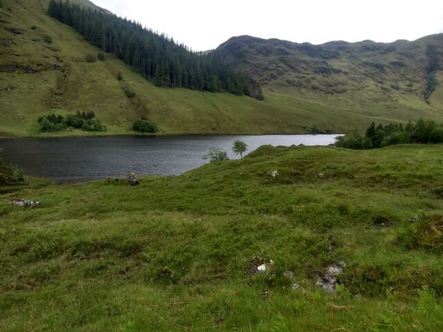
Meall Sguman, the hill of the cone-shaped haystack, is a 544m heather summit in the Attadale forest east of Lochcarron. The position between Glen Carron and Glen Ling gives it an outlook over both glens and across to the Strathfarrar Munros.
Quick facts
- Height
- 544m/ 1785ft
- Prominence
- 153 m
- Grid ref
- NH 02277 26708
- Nearest city
- Inverness· 67km
- Dogs
- Dogs on lead required near livestockDog-friendly guide ↗
Height and prominence cross-checked against the Database of British and Irish Hills (CC BY).
No GPX track yet
Walked this route? Share your track to help other walkers.
Standard route
heather moorland 55% · rocky slopes 30% · grass slopes 15%
From the small road end at Strathcarron station, take the path south up the Allt a Chruinn into the Attadale estate, then break east up rough heather to the summit. A trackless upper section and a fairly remote feel. Around 4 to 5 hours.
Terrain
Attadale estate path low down through scattered Scots pine, then deep tussock and heather on the upper slopes. The ground drains poorly off the broad summit and is reliably wet underfoot.
In winter
A 544m hill on the Lochcarron side of the watershed: snow lies sporadically through winter, never deeply. The hazards are frozen burns to cross and wet ground glazed by overnight frost. Spikes and a short axe usually sufficient.
Best time of year
Getting there
- Glasgow5h 33m
- Edinburgh6h 25m
OS maps: OS Landranger 25, OS Landranger 33, OS Explorer 414N
Mobile signal: Patchy. Lochcarron transmitters reach the summit; the approach glen is dead ground.
Current conditions
Daylight Today
- Sunrise
- 05:14
- Sunset
- 21:41
- Civil dawn
- 04:21
- Civil dusk
- 22:34
NOAA Solar Calculator · 30 July 2026
Around Meall Sguman on the SCOT network
Getting there, basing yourself, and what to do off the hill.
Meall Sguman — common questions
- Is Meall Sguman a hard climb?
- Meall Sguman is rated 2/5 (moderate) on the OutdoorSCOT scale. Terrain: Attadale estate path low down through scattered Scots pine, then deep tussock and heather on the upper slopes.
- How prominent is Meall Sguman?
- Meall Sguman has 153m of topographic prominence — the height of its summit above the highest col connecting it to higher ground. Marilyns are defined by that measure: at least 150m of drop on all sides.
- When should I climb Meall Sguman?
- The standard good-weather months for Meall Sguman are March, April, May, June, July, August, September, October. Outside those months, expect winter conditions on the high ground — full mountain kit, navigation skills, and a check of the SAIS avalanche forecast for the relevant region.
- Can I bring my dog up Meall Sguman?
- On a lead only — the route crosses ground with livestock or nesting-bird interest.
- What's mobile reception like on Meall Sguman?
- Patchy. Lochcarron transmitters reach the summit; the approach glen is dead ground.
- Is Meall Sguman safe in winter?
- A 544m hill on the Lochcarron side of the watershed: snow lies sporadically through winter, never deeply. The hazards are frozen burns to cross and wet ground glazed by overnight frost. Spikes and a short axe usually sufficient.
Get the OutdoorSCOT weekly
One email a week — new route, hill and bothy guides, seasonal conditions and the odd hard-won lesson. No spam, unsubscribe in one click.