Sub-Marilyn · Kintail
Carn Bad a' Chreamha
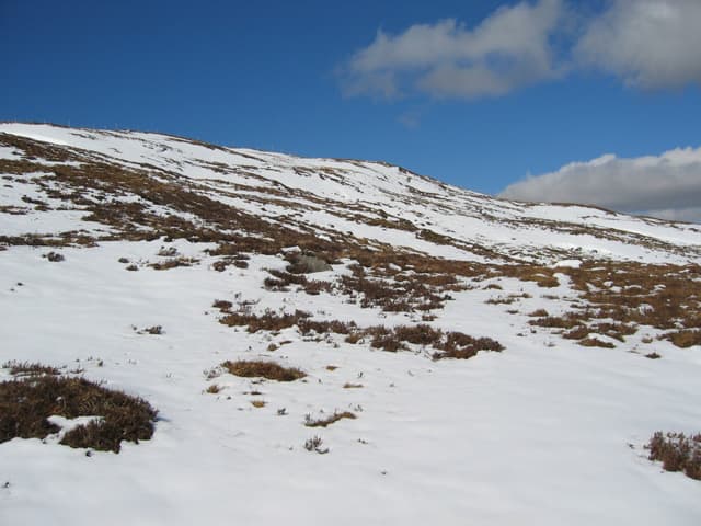
Carn Bad a Chreamha, the cairn of the wild garlic clump, is a 633m heather hill in the wide country between Glen Elchaig and the head of Loch Long near Killilan. The view extends east to the Five Sisters and west across Loch Long to Plockton.
Quick facts
- Height
- 633.3m/ 2078ft
- Prominence
- 147 m
- Grid ref
- NG 92581 26449
- Nearest city
- Inverness· 76km
- Dogs
- Dogs on lead required near livestockDog-friendly guide ↗
Sub-Marilyn: 147m of drop — misses the 150m Marilyn cut by 3m. We keep it on the list as a near-miss.
Height and prominence cross-checked against the Database of British and Irish Hills (CC BY).
No GPX track yet
Walked this route? Share your track to help other walkers.
Standard route
heather moorland 65% · grass slopes 25% · rocky summit 10%
Best from Killilan at the head of Loch Long via the estate track up Glen Elchaig, then a stiff pull south onto the heather flank. Around 5 hours including the inward track. A bike on the estate road saves an hour.
Terrain
Glen Elchaig estate track for the first miles, then open hillside of heather, deer-grass and short scattered rock. The lower glen has the eponymous wild garlic in spring, lining the burnsides.
In winter
At 633m the summit holds snow through January and February most years and the broad heather flanks can be slow going under a soft cover. Avalanche risk is low but the descent in poor light is awkward. Axe and crampons useful from mid-December.
Best time of year
Getting there
- Glasgow5h 48m
- Edinburgh7h 46m
OS maps: OS Landranger 25, OS Landranger 33, OS Explorer 413N
Mobile signal: Poor. Glen Elchaig is a deep glen with little reception; signal returns on the upper hill looking west to Plockton.
Current conditions
Daylight Today
- Sunrise
- 06:50
- Sunset
- 19:46
- Civil dawn
- 06:10
- Civil dusk
- 20:25
NOAA Solar Calculator · 14 September 2026
Around Carn Bad a' Chreamha on the SCOT network
Getting there, basing yourself, and what to do off the hill.
Carn Bad a' Chreamha — common questions
- How difficult is Carn Bad a' Chreamha?
- Carn Bad a' Chreamha carries a 2/5 (moderate) grade on the OutdoorSCOT scale. Ground conditions: Glen Elchaig estate track for the first miles, then open hillside of heather, deer-grass and short scattered rock.
- How much drop does Carn Bad a' Chreamha have?
- The drop is 147m: measured from the summit of Carn Bad a' Chreamha down to the saddle joining it to higher terrain. That leaves it 3m short of the 150m drop a Marilyn needs — DoBIH classes it a sub-Marilyn, a near-miss rather than a full Marilyn.
- What's the best month to climb Carn Bad a' Chreamha?
- Aim for March, April, May, June, July, August, September, October on Carn Bad a' Chreamha. In the remaining months treat it as a winter hill — full kit, solid navigation, and a look at the relevant SAIS avalanche forecast before you go.
- Can dogs go up Carn Bad a' Chreamha?
- Dogs are fine on a lead. The route passes livestock or ground-nesting bird habitat, so keep them close throughout.
- Will I get phone signal on Carn Bad a' Chreamha?
- Poor. Glen Elchaig is a deep glen with little reception; signal returns on the upper hill looking west to Plockton.
- Is Carn Bad a' Chreamha safe in winter?
- At 633m the summit holds snow through January and February most years and the broad heather flanks can be slow going under a soft cover. Avalanche risk is low but the descent in poor light is awkward. Axe and crampons useful from mid-December.
Get the OutdoorSCOT weekly
One email a week — new route, hill and bothy guides, seasonal conditions and the odd hard-won lesson. No spam, unsubscribe in one click.