Marilyn · North-West Highlands
Meall nan Clach Ruadha
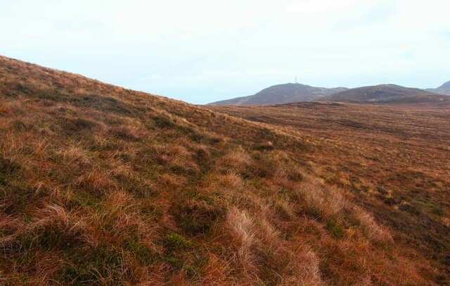
Meall nan Clach Ruadha — "hill of the red stones" — is a 336m moor in the NC60 grid square between the Kyle of Tongue and Loch Loyal. Its name is a direct reference to the rusty-coloured Old Red Sandstone scatter near the cairn.
Quick facts
- Height
- 336m/ 1102ft
- Prominence
- 171 m
- Grid ref
- NC 60516 56979
- Dogs
- Dogs on lead required near livestockDog-friendly guide ↗
Height and prominence cross-checked against the Database of British and Irish Hills (CC BY).
No GPX track yet
Walked this route? Share your track to help other walkers.
Standard route
heather and bog 55% · rocky slopes 30% · grass slopes 15%
Park in Tongue village and use the road south, then leave it at Coldbackie and climb the gentle northeast flank over heather and rusty sandstone. About 3 hours, with the Kyle of Tongue and Ben Loyal in view throughout.
Terrain
Heather and sandstone slabs underfoot, with the red-stained boulders near the top making the cairn unmistakable.
In winter
Frost can paint the red stones with white rime — a striking sight. The route is short enough for a winter half-day but still exposed to the Pentland Firth gales.
This hill is in the Torridon SAIS forecast area. Check SAIS forecasts in winter (December–April).
Best time of year
Getting there
- Glasgow7h 47m
- Edinburgh7h 15m
OS maps: OS Landranger 10, OS Explorer 447N, OS Explorer 448N
Mobile signal: Poor. Signal drops on the glen approach; summit is a complete dead zone.
Current conditions
Daylight Today
- Sunrise
- 05:03
- Sunset
- 21:45
- Civil dawn
- 04:07
- Civil dusk
- 22:41
NOAA Solar Calculator · 30 July 2026
Around Meall nan Clach Ruadha on the SCOT network
Getting there, basing yourself, and what to do off the hill.
Meall nan Clach Ruadha — common questions
- How hard is Meall nan Clach Ruadha?
- We grade Meall nan Clach Ruadha at 1/5, which puts it in easy territory. Underfoot: Heather and sandstone slabs underfoot, with the red-stained boulders near the top making the cairn unmistakable.
- What is Meall nan Clach Ruadha's prominence?
- 171m of prominence. That's the vertical drop from the summit to the col that links Meall nan Clach Ruadha to the next higher ground. That drop is what qualifies it as a Marilyn — a hill with at least 150m of descent on every side.
- When is the best time to climb Meall nan Clach Ruadha?
- March, April, May, June, July, August, September, October give the most reliable conditions on Meall nan Clach Ruadha. Beyond that window the high ground turns wintry: carry full mountain kit, be confident navigating, and check the SAIS avalanche forecast for the area.
- Is Meall nan Clach Ruadha dog-friendly?
- Yes, but dogs must be kept on a lead — there is livestock or ground-nesting bird interest on the route.
- Is there mobile signal on Meall nan Clach Ruadha?
- Poor. Signal drops on the glen approach; summit is a complete dead zone.
- Is Meall nan Clach Ruadha safe in winter?
- Frost can paint the red stones with white rime — a striking sight. The route is short enough for a winter half-day but still exposed to the Pentland Firth gales.
Get the OutdoorSCOT weekly
One email a week — new route, hill and bothy guides, seasonal conditions and the odd hard-won lesson. No spam, unsubscribe in one click.