Marilyn · North-West Highlands
Ben Hiel
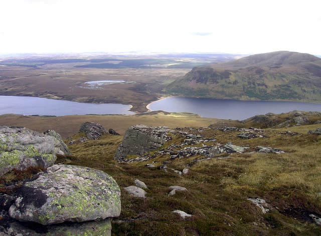
Ben Hiel is a steep-sided 535m cone in the NC59 grid square, sitting above the south end of the Kyle of Tongue and forming a distinctive horizon from the village.
Quick facts
- Height
- 535m/ 1755ft
- Prominence
- 210 m
- Grid ref
- NC 59583 50038
- Dogs
- Dogs on lead required near livestockDog-friendly guide ↗
Height and prominence cross-checked against the Database of British and Irish Hills (CC BY).
No GPX track yet
Walked this route? Share your track to help other walkers.
Standard route
blanket bog 50% · heather moorland 35% · rocky summit 15%
Park near the road bridge at Coldbackie or by the Kinloch estate, then take the old stalkers path up the western flank before a final push over heather to the summit cairn. Roughly 4 hours.
Terrain
A short steep climb on heather and bracken with sandstone outcrops near the top. Lower slopes can be tick-heavy in summer; bracken hides ankle traps.
In winter
Snow lies briefly on the conical summit but the wind off the Kyle of Tongue can be brutal. Cornice formation on the north edge is occasional; check before approaching the lip.
This hill is in the Torridon SAIS forecast area. Check SAIS forecasts in winter (December–April).
Best time of year
Getting there
- Glasgow7h 37m
- Edinburgh7h 7m
OS maps: OS Landranger 10, OS Explorer 447N, OS Explorer 447S, OS Explorer 448N
Mobile signal: Poor. Very remote Sutherland glen; no mobile infrastructure within range.
Current conditions
Daylight Today
- Sunrise
- 05:04
- Sunset
- 21:45
- Civil dawn
- 04:08
- Civil dusk
- 22:41
NOAA Solar Calculator · 30 July 2026
Around Ben Hiel on the SCOT network
Getting there, basing yourself, and what to do off the hill.
Ben Hiel — common questions
- What difficulty is Ben Hiel?
- On the OutdoorSCOT scale, Ben Hiel comes in at 2/5 — moderate. Ground conditions: A short steep climb on heather and bracken with sandstone outcrops near the top.
- How much drop does Ben Hiel have?
- The drop is 210m: measured from the summit of Ben Hiel down to the saddle joining it to higher terrain. Passing the 150m-drop threshold on all sides is exactly what makes it a Marilyn.
- What's the best month to climb Ben Hiel?
- Aim for March, April, May, June, July, August, September, October on Ben Hiel. In the remaining months treat it as a winter hill — full kit, solid navigation, and a look at the relevant SAIS avalanche forecast before you go.
- Can dogs go up Ben Hiel?
- Dogs are fine on a lead. The route passes livestock or ground-nesting bird habitat, so keep them close throughout.
- Will I get phone signal on Ben Hiel?
- Poor. Very remote Sutherland glen; no mobile infrastructure within range.
- Is Ben Hiel safe in winter?
- Snow lies briefly on the conical summit but the wind off the Kyle of Tongue can be brutal. Cornice formation on the north edge is occasional; check before approaching the lip.
Get the OutdoorSCOT weekly
One email a week — new route, hill and bothy guides, seasonal conditions and the odd hard-won lesson. No spam, unsubscribe in one click.