Marilyn · Glen Coe & Lochaber
Meall Luidh Mor
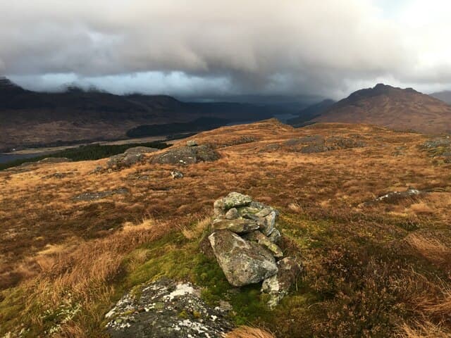
Meall Luidh Mor is a 514m Marilyn in NN-square Lochaber, planted on the empty moorland between Loch Ericht and the southern end of Loch Treig. The summit is one of the more isolated Marilyns of the Ossian Forest, with views ranging from Ben Alder in the east to the Aonachs in the west.
Gaelic: “rounded hill, big” · Pronunciation: myowl luidh more
Quick facts
- Height
- 514m/ 1686ft
- Prominence
- 153 m
- Grid ref
- NN 41697 79709
- Nearest city
- Fort William· 32km
- Dogs
- Dogs on lead required near livestockDog-friendly guide ↗
Height and prominence cross-checked against the Database of British and Irish Hills (CC BY).
No GPX track yet
Walked this route? Share your track to help other walkers.
Standard route
heather moorland 65% · bog and rushes 25% · grassy summit 10%
Easiest access is by Corrour train, then on foot east along Strath Ossian or by following the Allt Eigheach south from the Rannoch road. Whichever way is chosen, expect a long pathless trudge over moor; the summit itself is reached up an unremarkable grassy shoulder.
Terrain
Classic central-Highland bog with cotton-grass and sphagnum on the approach, then drier mossy grass on the upper slopes. The Uisge Labhair (loud river) divides the area and is a serious obstacle in spate.
In winter
A 514m hill in a high snow-catchment — drifts pile against the south-east slope through late winter. The lonely setting means rescue is hours away; carry self-sufficiency kit including bivvy bag and a stove.
This hill is in the Glen Coe SAIS forecast area. Check SAIS forecasts in winter (December–April).
Best time of year
Getting there
- Glasgow3h 47m
- Edinburgh4h 22m
OS maps: OS Landranger 42, OS Explorer 050, OS Explorer 393
Mobile signal: Poor. Remote Loch Tulla/Rannoch area; limited coverage.
Current conditions
Daylight Today
- Sunrise
- 05:13
- Sunset
- 21:36
- Civil dawn
- 04:22
- Civil dusk
- 22:28
NOAA Solar Calculator · 30 July 2026
Around Meall Luidh Mor on the SCOT network
Getting there, basing yourself, and what to do off the hill.
Meall Luidh Mor — common questions
- How hard is Meall Luidh Mor?
- We grade Meall Luidh Mor at 2/5, which puts it in moderate territory. Terrain: Classic central-Highland bog with cotton-grass and sphagnum on the approach, then drier mossy grass on the upper slopes.
- How prominent is Meall Luidh Mor?
- Meall Luidh Mor has 153m of topographic prominence — the height of its summit above the highest col connecting it to higher ground. Marilyns are defined by that measure: at least 150m of drop on all sides.
- When should I climb Meall Luidh Mor?
- The standard good-weather months for Meall Luidh Mor are March, April, May, June, July, August, September, October. Outside those months, expect winter conditions on the high ground — full mountain kit, navigation skills, and a check of the SAIS avalanche forecast for the relevant region.
- Can I bring my dog up Meall Luidh Mor?
- On a lead only — the route crosses ground with livestock or nesting-bird interest.
- What's mobile reception like on Meall Luidh Mor?
- Poor. Remote Loch Tulla/Rannoch area; limited coverage.
- Is Meall Luidh Mor safe in winter?
- A 514m hill in a high snow-catchment — drifts pile against the south-east slope through late winter. The lonely setting means rescue is hours away; carry self-sufficiency kit including bivvy bag and a stove.
Get the OutdoorSCOT weekly
One email a week — new route, hill and bothy guides, seasonal conditions and the odd hard-won lesson. No spam, unsubscribe in one click.