Marilyn · Glen Coe & Lochaber
Beinn a' Mhonicag
Beinn a Mhonicag sits at 567m in the rough country between Loch Laggan and the Great Glen, north of Tulloch station and west of the Corrieyairack Pass. It is a remote outlier of the Monadhliath, more often seen from the West Highland railway than walked.
Quick facts
- Height
- 567m/ 1860ft
- Prominence
- 268 m
- Grid ref
- NN 28791 85484
- Nearest city
- Fort William· 21km
- Dogs
- Dogs on lead required near livestockDog-friendly guide ↗
Height and prominence cross-checked against the Database of British and Irish Hills (CC BY).
No GPX track yet
Walked this route? Share your track to help other walkers.
Standard route
heather moorland 65% · grass slopes 25% · rocky summit 10%
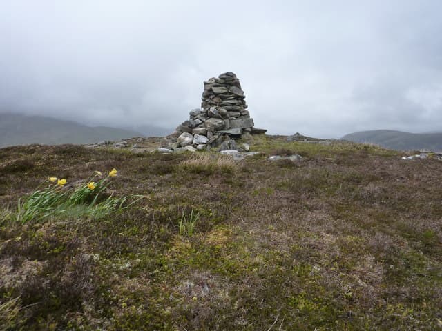
Most parties start from the lay-by on the A86 at Inverlair, follow the forest track up the Allt Daim and then strike north onto open heather. A long, trackless slog over peat hag to a small cairn — 4 to 5 hours circular and a serious day in poor weather.
Terrain
Forest tracks for the first part of the ascent, then notoriously tussocky peat ground typical of the southern Monadhliath. Drainage is poor across the broad summit plateau and pace slows to a crawl in the wet.
In winter
At 567m the summit gets a fair share of snow off the Atlantic, but the broad plateau usually packs hard rather than holding deep drifts. The real winter problem is route-finding across featureless ground; carry a map case and bearing-checked compass.
This hill is in the Glen Coe SAIS forecast area. Check SAIS forecasts in winter (December–April).
Best time of year
Getting there
- Glasgow3h 7m
- Edinburgh5h 54m
OS maps: OS Landranger 34, OS Landranger 41, OS Explorer 400
Mobile signal: Poor. No reliable coverage between Tulloch and Garva Bridge; the railway corridor below has intermittent signal.
Current conditions
Daylight Today
- Sunrise
- 05:14
- Sunset
- 21:37
- Civil dawn
- 04:22
- Civil dusk
- 22:29
NOAA Solar Calculator · 30 July 2026
Around Beinn a' Mhonicag on the SCOT network
Getting there, basing yourself, and what to do off the hill.
Base yourself in Fort William
Ben Nevis base, West Highland Line, gateway to Lochaber
21km from the hill
tripscot.co.uk
On TasteSCOTAfter the hill: Ben Nevis Distillery
Fort William — Lochaber distillery at the foot of the Ben; long-aged Japanese-owned classics
19km from the hill
tastescot.co.uk
Beinn a' Mhonicag — common questions
- How hard is Beinn a' Mhonicag?
- We grade Beinn a' Mhonicag at 2/5, which puts it in moderate territory. Terrain: Forest tracks for the first part of the ascent, then notoriously tussocky peat ground typical of the southern Monadhliath.
- How prominent is Beinn a' Mhonicag?
- Beinn a' Mhonicag has 268m of topographic prominence — the height of its summit above the highest col connecting it to higher ground. Marilyns are defined by that measure: at least 150m of drop on all sides.
- When should I climb Beinn a' Mhonicag?
- The standard good-weather months for Beinn a' Mhonicag are March, April, May, June, July, August, September, October. Outside those months, expect winter conditions on the high ground — full mountain kit, navigation skills, and a check of the SAIS avalanche forecast for the relevant region.
- Can I bring my dog up Beinn a' Mhonicag?
- On a lead only — the route crosses ground with livestock or nesting-bird interest.
- What's mobile reception like on Beinn a' Mhonicag?
- Poor. No reliable coverage between Tulloch and Garva Bridge; the railway corridor below has intermittent signal.
- Is Beinn a' Mhonicag safe in winter?
- At 567m the summit gets a fair share of snow off the Atlantic, but the broad plateau usually packs hard rather than holding deep drifts. The real winter problem is route-finding across featureless ground; carry a map case and bearing-checked compass.
Get the OutdoorSCOT weekly
One email a week — new route, hill and bothy guides, seasonal conditions and the odd hard-won lesson. No spam, unsubscribe in one click.