Marilyn · Cairngorms
Meall Alvie
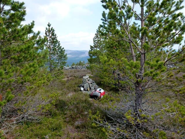
A 560m hummocky outlier of the Balmoral Forest immediately south of Crathie, with the royal house and the white Cairn na Cuimhne war memorial visible from the lower slopes. The pine-clad lower flanks are part of one of Scotlands more famous estates, and access during the late summer is restricted by stalking.
Quick facts
- Height
- 560.3m/ 1838ft
- Prominence
- 210 m
- Grid ref
- NO 20345 91913
- Nearest city
- Aberdeen· 75km
- Dogs
- Dogs on lead required near livestockDog-friendly guide ↗
Height and prominence cross-checked against the Database of British and Irish Hills (CC BY).
No GPX track yet
Walked this route? Share your track to help other walkers.
Standard route
heather moorland 60% · pinewood 25% · rocky summit 15%
The recommended start is at the Easter Balmoral track. After climbing through pine and birch, take the eastern shoulder onto the open moor for the final stony pull. About 8km return in 3 hours.
Terrain
Heather and granite chips on the upper hill; below the treeline expect mature Scots pine and a deer-fenced enclosure. Two stiles cross the fence at marked points.
In winter
Sheltered Balmoral pinewoods can be magical under snow. Above the trees the wind picks up considerably; route-find carefully if visibility drops on the broad rounded summit.
This hill is in the Northern Cairngorms SAIS forecast area. Check SAIS forecasts in winter (December–April).
Best time of year
Getting there
- Glasgow4h 50m
- Edinburgh3h 46m
OS maps: OS Landranger 44, OS Explorer 053N, OS Explorer 058S, OS Explorer 388N, OS Explorer 404S
Mobile signal: Solid summit coverage; EE is dependable. Fine Strathspey views.
Current conditions
Daylight Today
- Sunrise
- 05:08
- Sunset
- 21:32
- Civil dawn
- 04:16
- Civil dusk
- 22:24
NOAA Solar Calculator · 30 July 2026
Around Meall Alvie on the SCOT network
Getting there, basing yourself, and what to do off the hill.
Getting there: Aviemore station
Cairngorm plateau; Lairig Ghru; Speyside Way; Glenmore
37km from the hill
tripscot.co.uk
On TripSCOTBase yourself in Ballater
Eastern Cairngorms / Royal Deeside
17km from the hill
tripscot.co.uk
On TasteSCOTAfter the hill: Royal Lochnagar
Balmoral — Queen Victoria's favourite; eastern Cairngorms setting
7km from the hill
tastescot.co.uk
Meall Alvie — common questions
- How hard is Meall Alvie?
- We grade Meall Alvie at 2/5, which puts it in moderate territory. Ground conditions: Heather and granite chips on the upper hill; below the treeline expect mature Scots pine and a deer-fenced enclosure.
- How much drop does Meall Alvie have?
- The drop is 210m: measured from the summit of Meall Alvie down to the saddle joining it to higher terrain. Passing the 150m-drop threshold on all sides is exactly what makes it a Marilyn.
- What's the best month to climb Meall Alvie?
- Aim for March, April, May, June, July, August, September, October on Meall Alvie. In the remaining months treat it as a winter hill — full kit, solid navigation, and a look at the relevant SAIS avalanche forecast before you go.
- Can dogs go up Meall Alvie?
- Dogs are fine on a lead. The route passes livestock or ground-nesting bird habitat, so keep them close throughout.
- Will I get phone signal on Meall Alvie?
- Solid summit coverage; EE is dependable. Fine Strathspey views.
- Is Meall Alvie safe in winter?
- Sheltered Balmoral pinewoods can be magical under snow. Above the trees the wind picks up considerably; route-find carefully if visibility drops on the broad rounded summit.
Get the OutdoorSCOT weekly
One email a week — new route, hill and bothy guides, seasonal conditions and the odd hard-won lesson. No spam, unsubscribe in one click.