Marilyn · Cairngorms
Craigendarroch
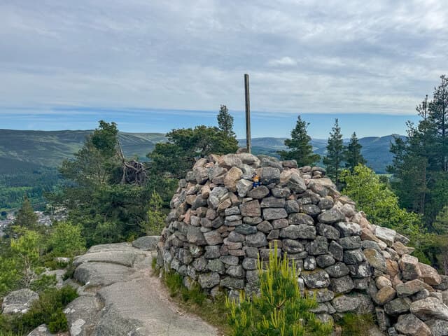
The Rock of Oaks, the wooded hill rising abruptly behind Ballater on Royal Deeside. Although only 402m, this little granite knoll is cloaked in one of the best surviving native sessile oakwoods in the eastern Highlands — a place of stunning autumn colour.
Quick facts
- Height
- 401.6m/ 1318ft
- Prominence
- 159 m
- Grid ref
- NO 36559 96523
- Nearest city
- Aberdeen· 59km
- Dogs
- Dogs on lead required near livestockDog-friendly guide ↗
Height and prominence cross-checked against the Database of British and Irish Hills (CC BY).
No GPX track yet
Walked this route? Share your track to help other walkers.
Standard route
oak woodland 35% · heather moorland 40% · rocky summit 25%
Several waymarked routes climb from Ballater village itself; the shortest is the steep direct path from the Pass of Ballater car park. A 4km return circuit with about 250m of ascent — comfortable in two hours.
Terrain
A network of well-maintained Forestry and Land Scotland paths through ancient oak and birch wood. Steep in places but the going is dry and firm.
In winter
A reliable winter outing — sheltered woodland keeps the worst of the wind off and the paths drain well. Some sections can ice up where springs cross the trail.
This hill is in the Northern Cairngorms SAIS forecast area. Check SAIS forecasts in winter (December–April).
Best time of year
Getting there
- Glasgow4h 23m
- Edinburgh3h 53m
OS maps: OS Landranger 37, OS Landranger 44, OS Explorer 053N, OS Explorer 059W, OS Explorer 388N, OS Explorer 405W
Mobile signal: Coverage is solid; steady on EE and Vodafone. Short popular Deeside walk above Ballater.
Current conditions
Daylight Today
- Sunrise
- 05:06
- Sunset
- 21:31
- Civil dawn
- 04:14
- Civil dusk
- 22:23
NOAA Solar Calculator · 30 July 2026
Around Craigendarroch on the SCOT network
Getting there, basing yourself, and what to do off the hill.
Getting there: Aviemore station
Cairngorm plateau; Lairig Ghru; Speyside Way; Glenmore
50km from the hill
tripscot.co.uk
On TripSCOTBase yourself in Ballater
Eastern Cairngorms / Royal Deeside
1km from the hill
tripscot.co.uk
On TasteSCOTAfter the hill: Royal Lochnagar
Balmoral — Queen Victoria's favourite; eastern Cairngorms setting
11km from the hill
tastescot.co.uk
Craigendarroch — common questions
- What difficulty is Craigendarroch?
- On the OutdoorSCOT scale, Craigendarroch comes in at 1/5 — easy. Terrain: A network of well-maintained Forestry and Land Scotland paths through ancient oak and birch wood.
- How prominent is Craigendarroch?
- Craigendarroch has 159m of topographic prominence — the height of its summit above the highest col connecting it to higher ground. Marilyns are defined by that measure: at least 150m of drop on all sides.
- When should I climb Craigendarroch?
- The standard good-weather months for Craigendarroch are March, April, May, June, July, August, September, October. Outside those months, expect winter conditions on the high ground — full mountain kit, navigation skills, and a check of the SAIS avalanche forecast for the relevant region.
- Can I bring my dog up Craigendarroch?
- On a lead only — the route crosses ground with livestock or nesting-bird interest.
- What's mobile reception like on Craigendarroch?
- Coverage is solid; steady on EE and Vodafone. Short popular Deeside walk above Ballater.
- Is Craigendarroch safe in winter?
- A reliable winter outing — sheltered woodland keeps the worst of the wind off and the paths drain well. Some sections can ice up where springs cross the trail.
Get the OutdoorSCOT weekly
One email a week — new route, hill and bothy guides, seasonal conditions and the odd hard-won lesson. No spam, unsubscribe in one click.