Marilyn · Cairngorms
Creag Ghiubhais
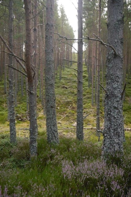
Creag Ghiubhais — pine crag — is a 486m wooded knoll on the north shore of the Dee opposite Ballater. The summit holds remnants of the great Mar pinewood, and a path winds among gnarled trees with views down over the river. A favourite afternoon outing for visitors staying in Royal Deeside.
Quick facts
- Height
- 486m/ 1594ft
- Prominence
- 205 m
- Grid ref
- NO 31247 95458
- Nearest city
- Aberdeen· 64km
- Dogs
- Dogs on lead required near livestockDog-friendly guide ↗
Height and prominence cross-checked against the Database of British and Irish Hills (CC BY).
No GPX track yet
Walked this route? Share your track to help other walkers.
Standard route
heather moorland 55% · pine woodland 25% · rocky summit 20%
Park at the Polveir wood car park east of Ballater and follow waymarked paths through the pines, climbing steadily to a rocky outlook just below the true top. A short pathless heather pull leads to the trig — 5km return in 1.5 to 2 hours.
Terrain
Pine needles and roots through the woodland section, with a few exposed slabs near the upper crag. The summit area is short heather with no scrambling required.
In winter
The forested approach offers shelter from wind and keeps the path snow-free under canopy. A clear winter day rewards with the white cap of Lochnagar filling the southern view across the Dee.
This hill is in the Northern Cairngorms SAIS forecast area. Check SAIS forecasts in winter (December–April).
Best time of year
Getting there
- Glasgow4h 12m
- Edinburgh3h 50m
OS maps: OS Landranger 37, OS Landranger 44, OS Explorer 053N, OS Explorer 388N
Mobile signal: Reliable up top; EE is dependable. Fine Deeside views.
Current conditions
Daylight Today
- Sunrise
- 05:07
- Sunset
- 21:31
- Civil dawn
- 04:15
- Civil dusk
- 22:23
NOAA Solar Calculator · 30 July 2026
Around Creag Ghiubhais on the SCOT network
Getting there, basing yourself, and what to do off the hill.
Getting there: Aviemore station
Cairngorm plateau; Lairig Ghru; Speyside Way; Glenmore
45km from the hill
tripscot.co.uk
On TripSCOTBase yourself in Ballater
Eastern Cairngorms / Royal Deeside
6km from the hill
tripscot.co.uk
On TasteSCOTAfter the hill: Royal Lochnagar
Balmoral — Queen Victoria's favourite; eastern Cairngorms setting
6km from the hill
tastescot.co.uk
Creag Ghiubhais — common questions
- Is Creag Ghiubhais a hard climb?
- Creag Ghiubhais is rated 1/5 (easy) on the OutdoorSCOT scale. Terrain: Pine needles and roots through the woodland section, with a few exposed slabs near the upper crag.
- How prominent is Creag Ghiubhais?
- Creag Ghiubhais has 205m of topographic prominence — the height of its summit above the highest col connecting it to higher ground. Marilyns are defined by that measure: at least 150m of drop on all sides.
- When should I climb Creag Ghiubhais?
- The standard good-weather months for Creag Ghiubhais are March, April, May, June, July, August, September, October. Outside those months, expect winter conditions on the high ground — full mountain kit, navigation skills, and a check of the SAIS avalanche forecast for the relevant region.
- Can I bring my dog up Creag Ghiubhais?
- On a lead only — the route crosses ground with livestock or nesting-bird interest.
- What's mobile reception like on Creag Ghiubhais?
- Reliable up top; EE is dependable. Fine Deeside views.
- Is Creag Ghiubhais safe in winter?
- The forested approach offers shelter from wind and keeps the path snow-free under canopy. A clear winter day rewards with the white cap of Lochnagar filling the southern view across the Dee.
Get the OutdoorSCOT weekly
One email a week — new route, hill and bothy guides, seasonal conditions and the odd hard-won lesson. No spam, unsubscribe in one click.