Sub-Marilyn · Cairngorms
Craig Leek
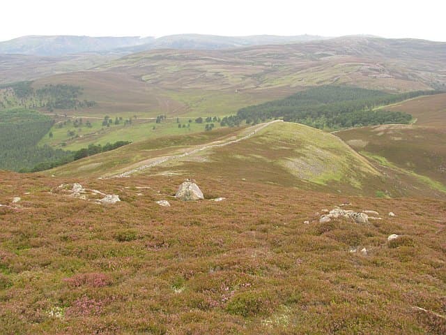
A craggy 634m hill on the north side of upper Deeside, overlooking Braemar. The southern face drops in granite slabs and screes towards the river, while the northern slopes melt into the long sweep of the Invercauld estate. A favourite winter scramble for climbers based at Braemar.
Quick facts
- Height
- 634.8m/ 2083ft
- Prominence
- 144 m
- Grid ref
- NO 18536 93050
- Nearest city
- Inverness· 73km
- Dogs
- Dogs on lead required near livestockDog-friendly guide ↗
Sub-Marilyn: 144m of drop — misses the 150m Marilyn cut by 6m. We keep it on the list as a near-miss.
Height and prominence cross-checked against the Database of British and Irish Hills (CC BY).
No GPX track yet
Walked this route? Share your track to help other walkers.
Standard route
heather moorland 65% · grass slopes 25% · rocky summit 10%
From the layby near Auchallater, take the right-of-way south of the Clunie Water then strike east up the gentle north flank, avoiding the southern crags. About 8km return in 3 to 4 hours.
Terrain
Native pine and juniper scrub on the lower slopes, opening to dry heather and granite slabs above. The summit area carries scattered boulders but no scrambling on the standard line.
In winter
Hold-overs of old snow can persist on the north flank into May. The southern crag-line is genuinely steep and avalanche-prone in heavy fresh snow — keep east of the summit on descent.
This hill is in the Northern Cairngorms SAIS forecast area. Check SAIS forecasts in winter (December–April).
Best time of year
Getting there
- Glasgow4h 48m
- Edinburgh3h 48m
OS maps: OS Landranger 36, OS Landranger 43, OS Explorer 053N, OS Explorer 058S, OS Explorer 388N, OS Explorer 404S
Mobile signal: Reliable up top; EE and Vodafone hold. Fine Deeside views.
Current conditions
Daylight Today
- Sunrise
- 05:08
- Sunset
- 21:32
- Civil dawn
- 04:16
- Civil dusk
- 22:24
NOAA Solar Calculator · 30 July 2026
Around Craig Leek on the SCOT network
Getting there, basing yourself, and what to do off the hill.
Getting there: Aviemore station
Cairngorm plateau; Lairig Ghru; Speyside Way; Glenmore
35km from the hill
tripscot.co.uk
On TripSCOTBase yourself in Ballater
Eastern Cairngorms / Royal Deeside
19km from the hill
tripscot.co.uk
On TasteSCOTAfter the hill: Royal Lochnagar
Balmoral — Queen Victoria's favourite; eastern Cairngorms setting
9km from the hill
tastescot.co.uk
Craig Leek — common questions
- How difficult is Craig Leek?
- Craig Leek carries a 2/5 (moderate) grade on the OutdoorSCOT scale. Underfoot: Native pine and juniper scrub on the lower slopes, opening to dry heather and granite slabs above.
- What is Craig Leek's prominence?
- 144m of prominence. That's the vertical drop from the summit to the col that links Craig Leek to the next higher ground. That leaves it 6m short of the 150m drop a Marilyn needs — DoBIH classes it a sub-Marilyn, a near-miss rather than a full Marilyn.
- When is the best time to climb Craig Leek?
- March, April, May, June, July, August, September, October give the most reliable conditions on Craig Leek. Beyond that window the high ground turns wintry: carry full mountain kit, be confident navigating, and check the SAIS avalanche forecast for the area.
- Is Craig Leek dog-friendly?
- Yes, but dogs must be kept on a lead — there is livestock or ground-nesting bird interest on the route.
- Is there mobile signal on Craig Leek?
- Reliable up top; EE and Vodafone hold. Fine Deeside views.
- Is Craig Leek safe in winter?
- Hold-overs of old snow can persist on the north flank into May. The southern crag-line is genuinely steep and avalanche-prone in heavy fresh snow — keep east of the summit on descent.
Get the OutdoorSCOT weekly
One email a week — new route, hill and bothy guides, seasonal conditions and the odd hard-won lesson. No spam, unsubscribe in one click.