Sub-Marilyn · Glen Coe & Lochaber
Meall a' Bhainne
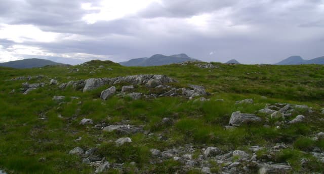
Meall a' Bhainne — the milk-coloured lump, named for its pale quartzite scree — is a 631m Marilyn in NN-square Lochaber, sitting on the ridge between Loch Ossian and Loch Treig east of Corrour. The summit looks across to the long bulk of Beinn na Lap and south toward the Rannoch Forest plantations.
Quick facts
- Height
- 631.6m/ 2072ft
- Prominence
- 148 m
- Grid ref
- NN 30635 66359
- Nearest city
- Fort William· 21km
- Dogs
- Dogs on lead required near livestockDog-friendly guide ↗
Sub-Marilyn: 148m of drop — misses the 150m Marilyn cut by 2m. We keep it on the list as a near-miss.
Height and prominence cross-checked against the Database of British and Irish Hills (CC BY).
No GPX track yet
Walked this route? Share your track to help other walkers.
Standard route
heather moorland 65% · grass slopes 25% · rocky summit 10%
The usual approach is by train to Corrour, then an estate track east toward Strathossian House before turning south onto the hill. Pathless going on rough grass and quartzite blocks brings walkers up the west shoulder to the cairn; the descent can be made north toward Loch Ossian for variation.
Terrain
Pale Cambrian quartzite forms gravel sheets near the summit, separated by mossy hollows. Approach ground is bog and bilberry, and water lies on the col after rain. No path.
In winter
A genuine 630m hill exposed to weather sweeping in from Rannoch Moor — snow collects in the steeper north-east bowls and rime is common. Train timetable governs day length; carry headtorch and bivvy bag against missed connections.
This hill is in the Glen Coe SAIS forecast area. Check SAIS forecasts in winter (December–April).
Best time of year
Getting there
- Glasgow3h 41m
- Edinburgh5h 36m
OS maps: OS Landranger 41, OS Explorer 385W
Mobile signal: Poor. Remote Loch Lochy/Great Glen area; limited coverage.
Current conditions
Daylight Today
- Sunrise
- 05:15
- Sunset
- 21:36
- Civil dawn
- 04:24
- Civil dusk
- 22:28
NOAA Solar Calculator · 30 July 2026
Around Meall a' Bhainne on the SCOT network
Getting there, basing yourself, and what to do off the hill.
Base yourself in Fort William
Ben Nevis base, West Highland Line, gateway to Lochaber
21km from the hill
tripscot.co.uk
On TasteSCOTAfter the hill: Ben Nevis Distillery
Fort William — Lochaber distillery at the foot of the Ben; long-aged Japanese-owned classics
21km from the hill
tastescot.co.uk
Meall a' Bhainne — common questions
- How hard is Meall a' Bhainne?
- We grade Meall a' Bhainne at 2/5, which puts it in moderate territory. Terrain: Pale Cambrian quartzite forms gravel sheets near the summit, separated by mossy hollows.
- How prominent is Meall a' Bhainne?
- Meall a' Bhainne has 148m of topographic prominence — the height of its summit above the highest col connecting it to higher ground. That leaves it 2m short of the 150m drop a Marilyn needs — DoBIH classes it a sub-Marilyn, a near-miss rather than a full Marilyn.
- When should I climb Meall a' Bhainne?
- The standard good-weather months for Meall a' Bhainne are March, April, May, June, July, August, September, October. Outside those months, expect winter conditions on the high ground — full mountain kit, navigation skills, and a check of the SAIS avalanche forecast for the relevant region.
- Can I bring my dog up Meall a' Bhainne?
- On a lead only — the route crosses ground with livestock or nesting-bird interest.
- What's mobile reception like on Meall a' Bhainne?
- Poor. Remote Loch Lochy/Great Glen area; limited coverage.
- Is Meall a' Bhainne safe in winter?
- A genuine 630m hill exposed to weather sweeping in from Rannoch Moor — snow collects in the steeper north-east bowls and rime is common. Train timetable governs day length; carry headtorch and bivvy bag against missed connections.
Get the OutdoorSCOT weekly
One email a week — new route, hill and bothy guides, seasonal conditions and the odd hard-won lesson. No spam, unsubscribe in one click.