Marilyn · North-West Highlands
Hill of Nigg
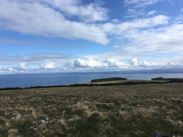
Hill of Nigg rises to 205m at NH 820 705 on the Nigg peninsula east of the Cromarty Firth, looking across Nigg Bay to the giant fabrication yard. The English name has displaced the older Gaelic; the summit is open coastal moor with views to the Sutors of Cromarty.
Quick facts
- Height
- 205m/ 673ft
- Prominence
- 191 m
- Grid ref
- NH 82062 70531
- Nearest city
- Inverness· 30km
- Dogs
- Dogs on lead required near livestockDog-friendly guide ↗
Height and prominence cross-checked against the Database of British and Irish Hills (CC BY).
No GPX track yet
Walked this route? Share your track to help other walkers.
Standard route
heather moorland 55% · coastal grass 30% · rocky summit 15%
From the unclassified road at Pitcalnie, a permissive track climbs the south slope to within 100m of the summit. The walk takes around 1.5 hours and is suitable for families.
Terrain
Devonian sandstone with thin acid soils. The summit is cropped heather and rough pasture grazed by sheep; lower slopes are arable fields. The proximity of the sea is felt in the salt-burnt vegetation on the east side.
In winter
Coastal and very low — snow is exceptional and rarely lies more than a day. A reliable winter walk when the hills behind are storm-bound; the wind from the firth can be biting on the exposed summit.
Best time of year
Getting there
- Glasgow5h 50m
- Edinburgh5h 59m
OS maps: OS Landranger 21, OS Explorer 438E
Mobile signal: Signal is good; EE seldom drops. Fine views across the Cromarty Firth.
Current conditions
Daylight Today
- Sunrise
- 06:43
- Sunset
- 19:40
- Civil dawn
- 06:04
- Civil dusk
- 20:20
NOAA Solar Calculator · 14 September 2026
Around Hill of Nigg on the SCOT network
Getting there, basing yourself, and what to do off the hill.
Getting there: Tain station
Easter Ross — Ben Wyvis approach, Glenmorangie distillery
12km from the hill
tripscot.co.uk
On TripSCOTBase yourself in Inverness
Highland capital — gateway to Cairngorms, Affric, Far North
30km from the hill
tripscot.co.uk
On TasteSCOTAfter the hill: Glenmorangie
Tain — Highland classic; tallest stills in Scotland; wood-finish pioneers
13km from the hill
tastescot.co.uk
Hill of Nigg — common questions
- How hard is Hill of Nigg?
- We grade Hill of Nigg at 1/5, which puts it in easy territory. Terrain: Devonian sandstone with thin acid soils.
- How prominent is Hill of Nigg?
- Hill of Nigg has 191m of topographic prominence — the height of its summit above the highest col connecting it to higher ground. Marilyns are defined by that measure: at least 150m of drop on all sides.
- When should I climb Hill of Nigg?
- The standard good-weather months for Hill of Nigg are March, April, May, June, July, August, September, October. Outside those months, expect winter conditions on the high ground — full mountain kit, navigation skills, and a check of the SAIS avalanche forecast for the relevant region.
- Can I bring my dog up Hill of Nigg?
- On a lead only — the route crosses ground with livestock or nesting-bird interest.
- What's mobile reception like on Hill of Nigg?
- Signal is good; EE seldom drops. Fine views across the Cromarty Firth.
- Is Hill of Nigg safe in winter?
- Coastal and very low — snow is exceptional and rarely lies more than a day. A reliable winter walk when the hills behind are storm-bound; the wind from the firth can be biting on the exposed summit.
Get the OutdoorSCOT weekly
One email a week — new route, hill and bothy guides, seasonal conditions and the odd hard-won lesson. No spam, unsubscribe in one click.