Marilyn · Kintail
Glas Bheinn
Glas Bheinn — the grey-green hill, one of many of the name — is a 397m summit on the Glenelg peninsula above Loch Alsh. It looks straight across the kyle to the Skye bridge and gives a remarkable view of the south Skye Cuillin in clear weather.
Gaelic: “grey-green” · Pronunciation: glass bheinn
Quick facts
- Height
- 397m/ 1302ft
- Grid ref
- NG 82165 22729
- Nearest city
- Inverness· 87km
- Dogs
- Dogs on lead required near livestockDog-friendly guide ↗
No GPX track yet
Walked this route? Share your track to help other walkers.
Standard route
rocky ridge 40% · heather moorland 35% · grass slopes 25%
A short outing from the unclassified road over Mam Ratagan, breaking off west onto the heather slopes and following the broad ridge to the cairn. Sometimes paired with a longer round to Beinn nan Caorach. About 2 hours from the road.
Terrain
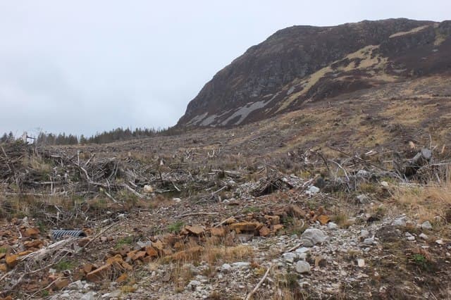
Open hill of short heather, grass and small schist outcrops. The Mam Ratagan side is drier than the southern flank; the broad ridge to the summit is easy walking once clear of the roadside drainage ditch.
In winter
A coastal 397m summit that takes wind off the kyle. Snow is rarely a problem; ice on the road over Mam Ratagan is more likely to scupper the day than conditions on the hill. Spikes for verglas above 300m in cold spells.
Best time of year
Getting there
- Glasgow5h 1m
- Edinburgh7h 6m
OS maps: OS Landranger 33, OS Explorer 413N
Mobile signal: Reasonable. Signal across the kyle to Skye and from Kyleakin masts; the summit area has line of sight to several transmitters.
Current conditions
Daylight Today
- Sunrise
- 04:28
- Sunset
- 22:23
- Civil dawn
- 03:19
- Civil dusk
- 23:32
NOAA Solar Calculator · 27 June 2026
Around Glas Bheinn on the SCOT network
Getting there, basing yourself, and what to do off the hill.
Glas Bheinn — common questions
- How hard is Glas Bheinn?
- Glas Bheinn is rated 1/5 (easy) on the OutdoorSCOT scale. Terrain: Open hill of short heather, grass and small schist outcrops.
- When is the best time to climb Glas Bheinn?
- The standard good-weather months for Glas Bheinn are March, April, May, June, July, August, September, October. Outside those months, expect winter conditions on the high ground — full mountain kit, navigation skills, and a check of the SAIS avalanche forecast for the relevant region.
- Can I bring my dog up Glas Bheinn?
- Yes, but dogs must be kept on a lead — there is livestock or ground-nesting bird interest on the route.
- Is there mobile signal on Glas Bheinn?
- Reasonable. Signal across the kyle to Skye and from Kyleakin masts; the summit area has line of sight to several transmitters.
- Is Glas Bheinn safe in winter?
- A coastal 397m summit that takes wind off the kyle. Snow is rarely a problem; ice on the road over Mam Ratagan is more likely to scupper the day than conditions on the hill. Spikes for verglas above 300m in cold spells.
Get the OutdoorSCOT weekly
One email a week — new route, hill and bothy guides, seasonal conditions and the odd hard-won lesson. No spam, unsubscribe in one click.