Sub-Marilyn · Galloway
Enoch Hill
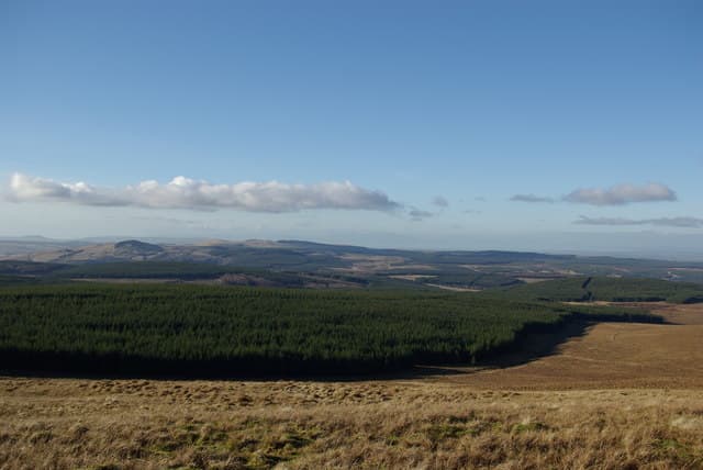
Enoch Hill sits at 569m on the NS-square moorlands above Loch Doon, an East Ayrshire summit on the fringe of the Galloway Hills. Its setting between reservoir and wind farm gives an otherwise quiet hill an unusual character.
Quick facts
- Height
- 569.1m/ 1867ft
- Prominence
- 144 m
- Grid ref
- NS 56214 06740
- Nearest city
- Dumfries· 51km
- Dogs
- Dogs on lead required near livestockDog-friendly guide ↗
Sub-Marilyn: 144m of drop — misses the 150m Marilyn cut by 6m. We keep it on the list as a near-miss.
Height and prominence cross-checked against the Database of British and Irish Hills (CC BY).
No GPX track yet
Walked this route? Share your track to help other walkers.
Standard route
heather moorland 65% · boggy ground 20% · grassy summit 15%
Approach via the wind-farm haul road from the B741 near Dalmellington or the forestry tracks west of Loch Doon, then strike up rough moor onto the open dome. Three to four hours allows for the boggier sections; a GPS is wise in low cloud.
Terrain
Deep heather, peat hags and old extraction scars combine into slow, energy-sapping ground. The wind-farm roads provide the only firm surface.
In winter
Frozen peat is far easier going than the summer slog, but blown snow gathers in the hags and conceals hidden holes. Visibility off the loch can drop suddenly.
Best time of year
Getting there
- Glasgow1h 21m
- Edinburgh3h 13m
OS maps: OS Landranger 71, OS Landranger 77, OS Explorer 327, OS Explorer 328S
Mobile signal: Poor. East Ayrshire moorland; limited coverage.
Current conditions
Daylight Today
- Sunrise
- 06:47
- Sunset
- 19:39
- Civil dawn
- 06:10
- Civil dusk
- 20:16
NOAA Solar Calculator · 14 September 2026
Around Enoch Hill on the SCOT network
Getting there, basing yourself, and what to do off the hill.
Enoch Hill — common questions
- How hard is Enoch Hill?
- We grade Enoch Hill at 2/5, which puts it in moderate territory. Ground conditions: Deep heather, peat hags and old extraction scars combine into slow, energy-sapping ground.
- How much drop does Enoch Hill have?
- The drop is 144m: measured from the summit of Enoch Hill down to the saddle joining it to higher terrain. That leaves it 6m short of the 150m drop a Marilyn needs — DoBIH classes it a sub-Marilyn, a near-miss rather than a full Marilyn.
- What's the best month to climb Enoch Hill?
- Aim for March, April, May, June, July, August, September, October on Enoch Hill. In the remaining months treat it as a winter hill — full kit, solid navigation, and a look at the relevant SAIS avalanche forecast before you go.
- Can dogs go up Enoch Hill?
- Dogs are fine on a lead. The route passes livestock or ground-nesting bird habitat, so keep them close throughout.
- Will I get phone signal on Enoch Hill?
- Poor. East Ayrshire moorland; limited coverage.
- Is Enoch Hill safe in winter?
- Frozen peat is far easier going than the summer slog, but blown snow gathers in the hags and conceals hidden holes. Visibility off the loch can drop suddenly.
Get the OutdoorSCOT weekly
One email a week — new route, hill and bothy guides, seasonal conditions and the odd hard-won lesson. No spam, unsubscribe in one click.