Marilyn · Galloway
Colt Hill
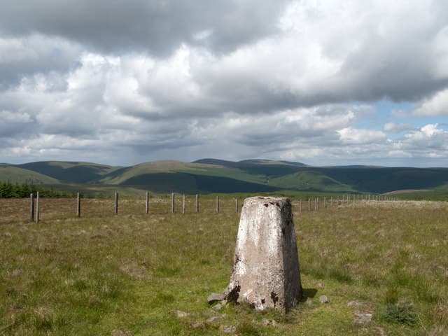
A 598m heather hill at NX 69 north-east of Carsphairn on the watershed between the Doon and the Ken. Colt Hill sits on the rolling ridges of the Glenkens with the Cairnsmore of Carsphairn group filling the southern view.
Quick facts
- Height
- 598m/ 1962ft
- Prominence
- 245 m
- Grid ref
- NX 69878 99009
- Nearest city
- Dumfries· 36km
- Dogs
- Dogs on lead required near livestockDog-friendly guide ↗
Height and prominence cross-checked against the Database of British and Irish Hills (CC BY).
No GPX track yet
Walked this route? Share your track to help other walkers.
Standard route
heather moorland 60% · grass slopes 30% · rocky summit 10%
From the A713 north of Carsphairn, start near Polmaddy and climb east through rough pasture onto the long summit ridge. The trig lies at the northern end — allow 3 to 4 hours for the round trip.
Terrain
Sheep pasture and heather; no paths on the upper hill. The ridge is broad and firm underfoot in dry conditions.
In winter
Higher Glenkens hills can hold snow in cold spells, especially on the north-facing slopes. Carry an axe for hard winter conditions above 500m.
Best time of year
Getting there
- Glasgow2h 37m
- Edinburgh3h 50m
OS maps: OS Landranger 77, OS Explorer 328S
Mobile signal: Good. East Ayrshire; solid EE signal on summit and approach.
Current conditions
Daylight Today
- Sunrise
- 06:46
- Sunset
- 19:38
- Civil dawn
- 06:09
- Civil dusk
- 20:15
NOAA Solar Calculator · 14 September 2026
Around Colt Hill on the SCOT network
Getting there, basing yourself, and what to do off the hill.
Colt Hill — common questions
- What difficulty is Colt Hill?
- On the OutdoorSCOT scale, Colt Hill comes in at 2/5 — moderate. Underfoot: Sheep pasture and heather; no paths on the upper hill.
- What is Colt Hill's prominence?
- 245m of prominence. That's the vertical drop from the summit to the col that links Colt Hill to the next higher ground. That drop is what qualifies it as a Marilyn — a hill with at least 150m of descent on every side.
- When is the best time to climb Colt Hill?
- March, April, May, June, July, August, September, October give the most reliable conditions on Colt Hill. Beyond that window the high ground turns wintry: carry full mountain kit, be confident navigating, and check the SAIS avalanche forecast for the area.
- Is Colt Hill dog-friendly?
- Yes, but dogs must be kept on a lead — there is livestock or ground-nesting bird interest on the route.
- Is there mobile signal on Colt Hill?
- Good. East Ayrshire; solid EE signal on summit and approach.
- Is Colt Hill safe in winter?
- Higher Glenkens hills can hold snow in cold spells, especially on the north-facing slopes. Carry an axe for hard winter conditions above 500m.
Get the OutdoorSCOT weekly
One email a week — new route, hill and bothy guides, seasonal conditions and the odd hard-won lesson. No spam, unsubscribe in one click.