Marilyn · Galloway
Cairnkinna Hill
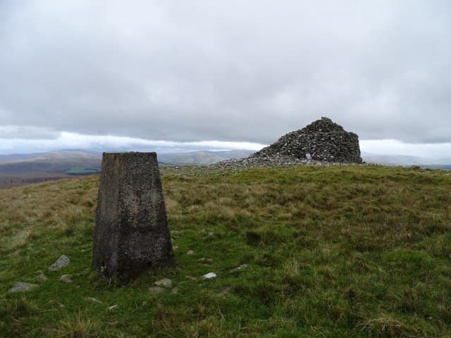
Cairnkinna Hill reaches 554m on the NS-grid Nithsdale uplands north-west of Thornhill, an underused Dumfriesshire summit close to the Scaur Water. Its open aspect repays the walker with views over to Queensberry and the Lowthers.
Quick facts
- Height
- 554m/ 1818ft
- Prominence
- 163 m
- Grid ref
- NS 79101 01857
- Nearest city
- Dumfries· 32km
- Dogs
- Dogs on lead required near livestockDog-friendly guide ↗
Height and prominence cross-checked against the Database of British and Irish Hills (CC BY).
No GPX track yet
Walked this route? Share your track to help other walkers.
Standard route
heather moorland 60% · grass slopes 30% · rocky summit 10%
Start from Penpont or the back lanes towards Tynron and follow estate tracks before breaking out onto the open hill. Two and a half to four hours covers the walk; the upper slopes are pathless but firm.
Terrain
Sheep-cropped pasture and broken heather with a band of scree around the upper crag. Drainage is reasonable for the area.
In winter
A reliable winter walk that stays under most snow lines. The exposed summit ridge catches the prevailing wind, so a wind-shell matters more than crampons.
Best time of year
Getting there
- Glasgow2h 42m
- Edinburgh3h 30m
OS maps: OS Landranger 78, OS Explorer 329
Mobile signal: Good. Dumfriesshire; EE reliable — Vodafone also gives a signal here.
Current conditions
Daylight Today
- Sunrise
- 05:19
- Sunset
- 21:25
- Civil dawn
- 04:31
- Civil dusk
- 22:13
NOAA Solar Calculator · 30 July 2026
Around Cairnkinna Hill on the SCOT network
Getting there, basing yourself, and what to do off the hill.
Cairnkinna Hill — common questions
- What difficulty is Cairnkinna Hill?
- On the OutdoorSCOT scale, Cairnkinna Hill comes in at 2/5 — moderate. Ground conditions: Sheep-cropped pasture and broken heather with a band of scree around the upper crag.
- How much drop does Cairnkinna Hill have?
- The drop is 163m: measured from the summit of Cairnkinna Hill down to the saddle joining it to higher terrain. Passing the 150m-drop threshold on all sides is exactly what makes it a Marilyn.
- What's the best month to climb Cairnkinna Hill?
- Aim for March, April, May, June, July, August, September, October on Cairnkinna Hill. In the remaining months treat it as a winter hill — full kit, solid navigation, and a look at the relevant SAIS avalanche forecast before you go.
- Can dogs go up Cairnkinna Hill?
- Dogs are fine on a lead. The route passes livestock or ground-nesting bird habitat, so keep them close throughout.
- Will I get phone signal on Cairnkinna Hill?
- Good. Dumfriesshire; EE reliable — Vodafone also gives a signal here.
- Is Cairnkinna Hill safe in winter?
- A reliable winter walk that stays under most snow lines. The exposed summit ridge catches the prevailing wind, so a wind-shell matters more than crampons.
Get the OutdoorSCOT weekly
One email a week — new route, hill and bothy guides, seasonal conditions and the odd hard-won lesson. No spam, unsubscribe in one click.