Marilyn · Perthshire
Dun Coillich
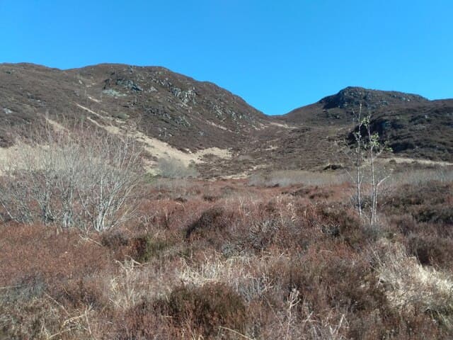
Dun Coillich is a 572m hill on the south side of Strath Tummel, at NN 762 536, owned and managed by the local Highland Perthshire community since 2002. The summit, marked by a cairn on a small rocky knoll, looks north across Loch Tummel to the Schiehallion ridge and south down toward Aberfeldy.
Quick facts
- Height
- 572m/ 1877ft
- Prominence
- 187 m
- Grid ref
- NN 76251 53639
- Nearest city
- Perth· 46km
- Dogs
- Dogs on lead required near livestockDog-friendly guide ↗
Height and prominence cross-checked against the Database of British and Irish Hills (CC BY).
No GPX track yet
Walked this route? Share your track to help other walkers.
Standard route
heather moorland 65% · grass slopes 25% · rocky summit 10%
From the small Dun Coillich community car park at Tomphubil on the B846 between Aberfeldy and Tummel Bridge, follow the marked community trail through native woodland regeneration plots and onto the open hill, with a final climb on a faint path to the summit cairn.
Terrain
Restored native woodland on the lower hill — newly planted birch, hazel and rowan — opening to grass and heather above. Some wet sections on the moor; a single fence to cross by a small gate.
In winter
Snow on the summit ridge is sporadic and rarely deep; the moor freezes hard in clear cold spells, making for easier crossing. Daylight is short — start early between November and February to be sure of getting off before dusk.
Best time of year
Getting there
- Glasgow2h 9m
- Edinburgh3h 49m
OS maps: OS Landranger 42, OS Landranger 51, OS Landranger 52, OS Explorer 049W, OS Explorer 386W
Mobile signal: Poor. No carrier reaches this summit; download offline maps before visiting.
Current conditions
Daylight Today
- Sunrise
- 05:12
- Sunset
- 21:33
- Civil dawn
- 04:21
- Civil dusk
- 22:24
NOAA Solar Calculator · 30 July 2026
Around Dun Coillich on the SCOT network
Getting there, basing yourself, and what to do off the hill.
Getting there: Blair Atholl station
Beinn a Ghlo; Glen Tilt corridor north to the Cairngorms
16km from the hill
tripscot.co.uk
On TripSCOTBase yourself in Aberfeldy
Loch Tay base — Ben Lawers, Tarmachan ridge, Birks of Aberfeldy
10km from the hill
tripscot.co.uk
On TasteSCOTAfter the hill: Aberfeldy
Aberfeldy — heart of Dewar's blends; honey-and-heather Highland style
11km from the hill
tastescot.co.uk
Dun Coillich — common questions
- How hard is Dun Coillich?
- We grade Dun Coillich at 2/5, which puts it in moderate territory. Underfoot: Restored native woodland on the lower hill — newly planted birch, hazel and rowan — opening to grass and heather above.
- What is Dun Coillich's prominence?
- 187m of prominence. That's the vertical drop from the summit to the col that links Dun Coillich to the next higher ground. That drop is what qualifies it as a Marilyn — a hill with at least 150m of descent on every side.
- When is the best time to climb Dun Coillich?
- March, April, May, June, July, August, September, October give the most reliable conditions on Dun Coillich. Beyond that window the high ground turns wintry: carry full mountain kit, be confident navigating, and check the SAIS avalanche forecast for the area.
- Is Dun Coillich dog-friendly?
- Yes, but dogs must be kept on a lead — there is livestock or ground-nesting bird interest on the route.
- Is there mobile signal on Dun Coillich?
- Poor. No carrier reaches this summit; download offline maps before visiting.
- Is Dun Coillich safe in winter?
- Snow on the summit ridge is sporadic and rarely deep; the moor freezes hard in clear cold spells, making for easier crossing. Daylight is short — start early between November and February to be sure of getting off before dusk.
Get the OutdoorSCOT weekly
One email a week — new route, hill and bothy guides, seasonal conditions and the odd hard-won lesson. No spam, unsubscribe in one click.