Marilyn · Perthshire
Drummond Hill
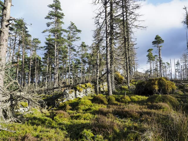
Drummond Hill rises to 460m between Kenmore and Fortingall above the foot of Loch Tay at NN 749 454. It was one of the first commercial forestry plantations in Scotland, planted from 1738 by the Duke of Atholl. The Black Rock viewpoint near the summit gives a celebrated view of Kenmore and the whole length of Loch Tay.
Quick facts
- Height
- 460m/ 1509ft
- Prominence
- 314 m
- Grid ref
- NN 74965 45482
- Nearest city
- Perth· 43km
- Dogs
- Dogs on lead required near livestockDog-friendly guide ↗
Height and prominence cross-checked against the Database of British and Irish Hills (CC BY).
No GPX track yet
Walked this route? Share your track to help other walkers.
Standard route
forestry tracks 40% · heather moorland 40% · summit area 20%
Start at the Forestry and Land Scotland car park west of Kenmore. Follow the red waymarkers up through Douglas fir and oak on the long western shoulder, breaking briefly off the main track to reach the Black Rock outcrop, then continuing to the OS pillar in a clearing on the summit ridge.
Terrain
Hard-surfaced forest roads throughout the main route, with a short branch track on muddy peat to the summit cairn. Underfoot conditions are excellent — almost all-weather.
In winter
A managed forest hill where the main winter concern is ice on the gritted roads and slippery roots on the branch path. Snow rarely lies long under the canopy but the open summit ridge gathers wind-blown drifts in cold easterlies.
Best time of year
Getting there
- Glasgow2h 57m
- Edinburgh3h 44m
OS maps: OS Landranger 51, OS Landranger 52, OS Explorer 048E, OS Explorer 378E
Mobile signal: Good signal throughout; EE seldom drops. Fine Loch Tay panorama.
Current conditions
Daylight Today
- Sunrise
- 05:13
- Sunset
- 21:32
- Civil dawn
- 04:22
- Civil dusk
- 22:23
NOAA Solar Calculator · 30 July 2026
Around Drummond Hill on the SCOT network
Getting there, basing yourself, and what to do off the hill.
Getting there: Pitlochry station
Schiehallion, Ben Vrackie, Beinn a Ghlo, Edradour distillery
23km from the hill
tripscot.co.uk
On TripSCOTBase yourself in Aberfeldy
Loch Tay base — Ben Lawers, Tarmachan ridge, Birks of Aberfeldy
11km from the hill
tripscot.co.uk
On TasteSCOTAfter the hill: Aberfeldy
Aberfeldy — heart of Dewar's blends; honey-and-heather Highland style
11km from the hill
tastescot.co.uk
Drummond Hill — common questions
- How difficult is Drummond Hill?
- Drummond Hill carries a 1/5 (easy) grade on the OutdoorSCOT scale. Terrain: Hard-surfaced forest roads throughout the main route, with a short branch track on muddy peat to the summit cairn.
- How prominent is Drummond Hill?
- Drummond Hill has 314m of topographic prominence — the height of its summit above the highest col connecting it to higher ground. Marilyns are defined by that measure: at least 150m of drop on all sides.
- When should I climb Drummond Hill?
- The standard good-weather months for Drummond Hill are March, April, May, June, July, August, September, October. Outside those months, expect winter conditions on the high ground — full mountain kit, navigation skills, and a check of the SAIS avalanche forecast for the relevant region.
- Can I bring my dog up Drummond Hill?
- On a lead only — the route crosses ground with livestock or nesting-bird interest.
- What's mobile reception like on Drummond Hill?
- Good signal throughout; EE seldom drops. Fine Loch Tay panorama.
- Is Drummond Hill safe in winter?
- A managed forest hill where the main winter concern is ice on the gritted roads and slippery roots on the branch path. Snow rarely lies long under the canopy but the open summit ridge gathers wind-blown drifts in cold easterlies.
Get the OutdoorSCOT weekly
One email a week — new route, hill and bothy guides, seasonal conditions and the odd hard-won lesson. No spam, unsubscribe in one click.